On this page
Walking the England Coast Path immediately before the start of the South West Coast Path.
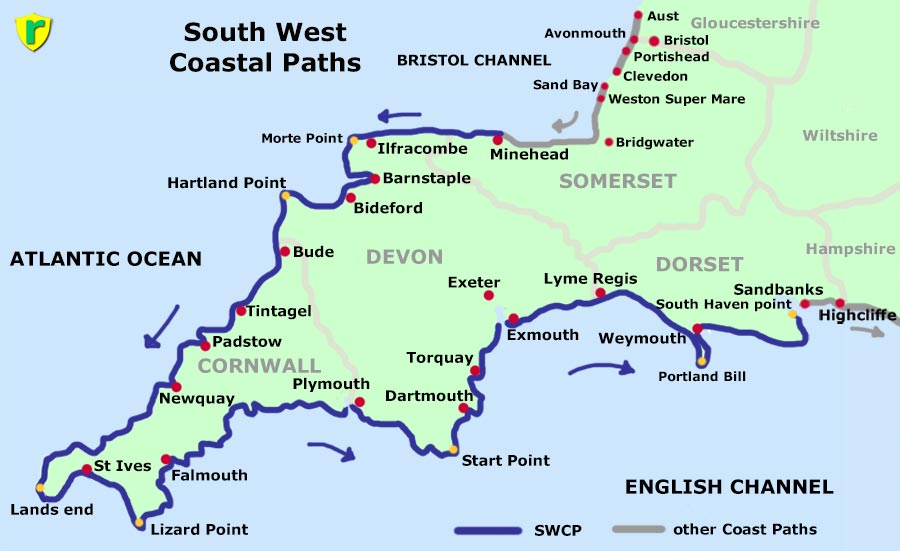
Walking the whole South West Coast Path.
Walking the coastal path in Dorset beyond the other end of the South West Coast Path.
England Coast Path:
South West Coast Path:
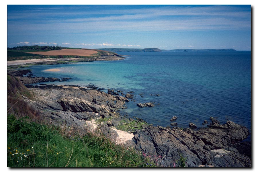
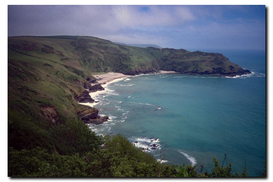
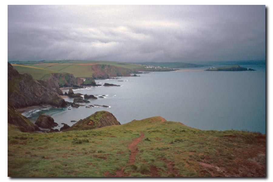
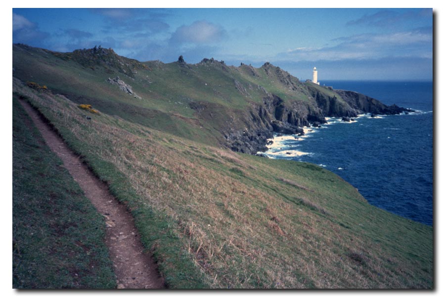
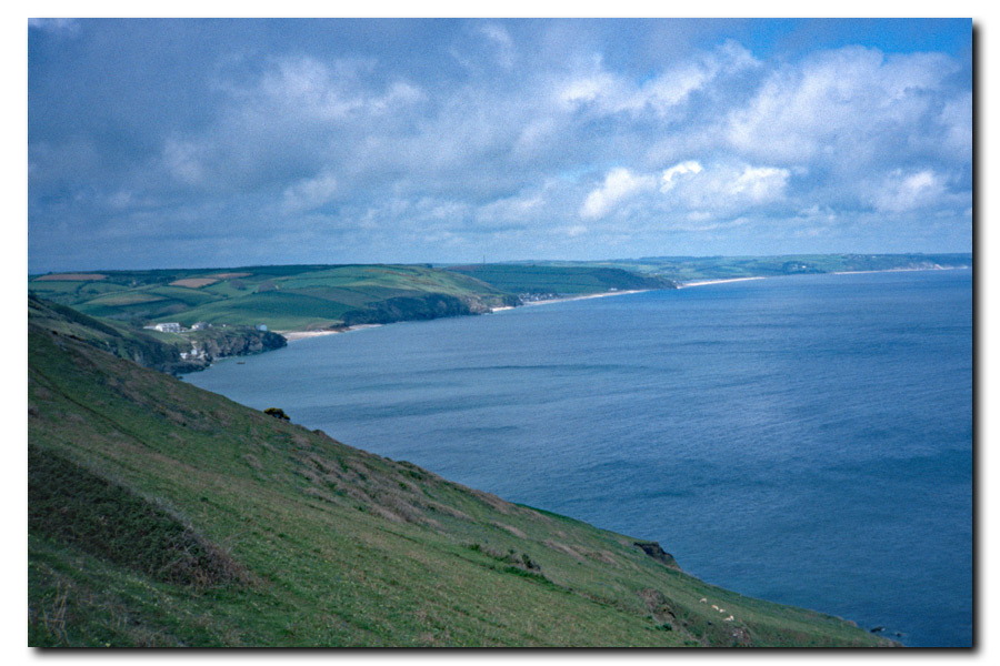
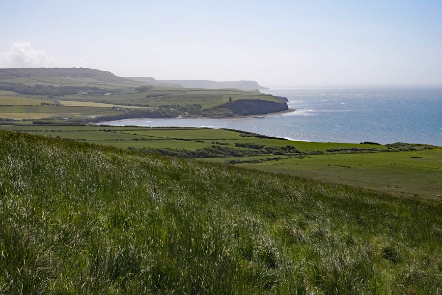
Lyme Regis to South Haven Point
Other coast Paths:
After completing the above walks I continued walking east, beyond Dorset, and started to walk the south east coast of England. These walks can be found on the South East page.
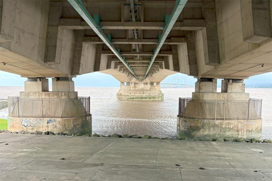
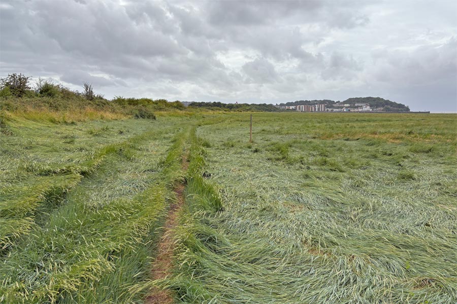
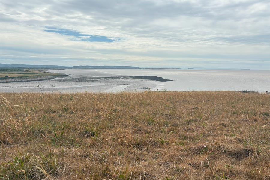
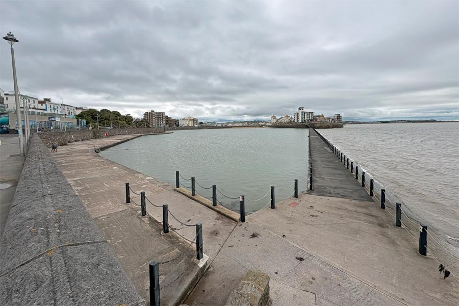
Old Passage Aust to Clevedon 2025
Aust, Severn Beach, Avonmouth, Portishead, Clevedon.
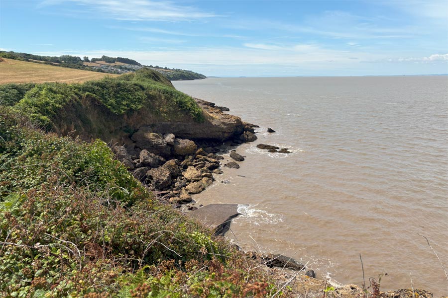
The England Coast Path begins at Old Passage near Aust in Gloucestershire and runs along the banks of the River Severn and Bristol Channel to Wains Hill, Clevedon in Somerset. From that point there are no suitable public footpaths until Sand Bay, near Weston Super Mare, where the ECP exists again and continues to where the South West Coast Path begins at Minehead in Somerset.
I stayed overnight with my sister in Bristol while did this short walk so I was able to get a lift to the start at Aust and then used buses to get to and from my daily start and finish points.
Day 1 - New Passage, Aust to Portishead.
 |
 |
| The old ferry approach and the Severn Bridge | The Prince of Wales Bridge |
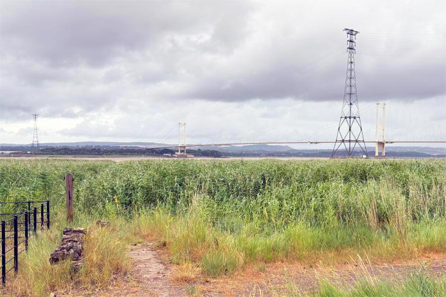
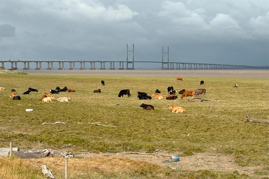
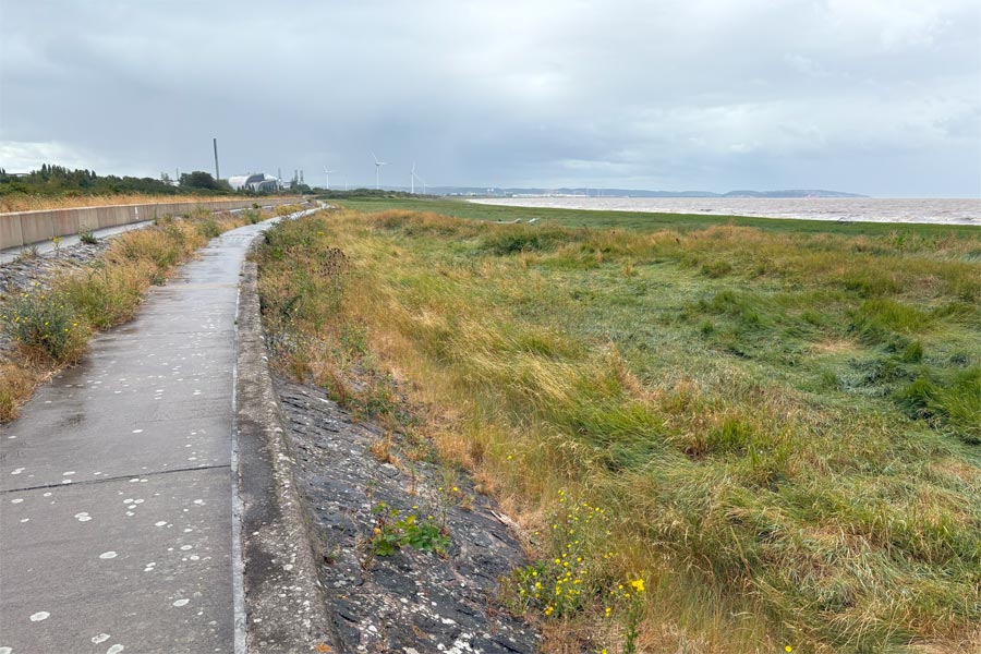
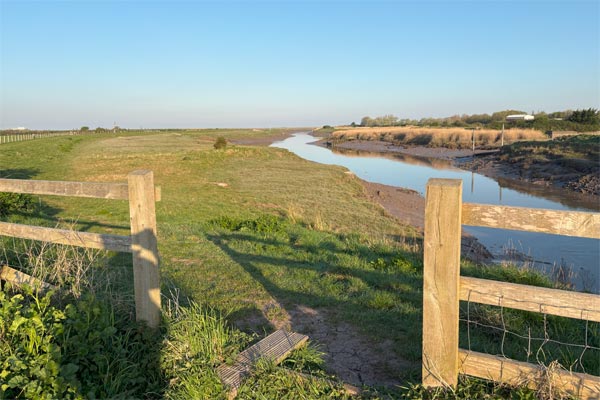
It was overcast and windy when I started my walk at Old Passage which is close to the first Severn bridge at Aust. As my sister drove away it started to rain and so I quickly donned my wet weather gear. I walked down to where the Aust to Beachly Ferry used to depart from but there was nothing left of the buildings or the wharf except for a row of rotting wooden posts and beams hidden in the long grass and reeds. I remembered having been on the Aust Ferry when I was a boy, which was before the Severn Bridge was built. As I turned to leave, the rain stopped so I removed my waterproofs. My Gore-tex coat and over-trousers are great for keeping dry but they cause me to overheat if I am walking any faster than strolling speed for too long. There was then a short walk along the side of a the road, but soon the path veered to the right and towards the river where it continued along the top of the flood prevention bank.
Now I was away from the road with just fields on one side and the huge Severn estuary on the other. It was a windy day with dark clouds racing by overhead and with the threat of rain, but I began to feel the exhilaration that I get when I leave the everyday behind and set out on a new trek. At that moment I had no real plans* in mind for the day, just a need to walk and absorb the sensations of the moment.
*Plans
I do plan my walks, in a rough sort of way to ensure that I know vaguely where I might be later each day but this can vary greatly depending on how I feel at the time. I generally like to average about fifteen miles a day but this could drop to twelve or increase to twenty or more depending on the weather or the difficulty of the terrain. On a long walk when I pre-book accommodation I have to stick to the planned mileage, but on this walk just I needed to be where I could catch a bus back to my sister's at the end of the day, and as I would be passing through several suitable places where I could do that, I didn't need to think about it until later.
After about 2 miles the flood bank passed beneath the wide, concrete roadway approach to the second Severn crossing on huge concrete pillars. The bridge is now called the Prince of Wales Bridge. Just beyond was the village of Severn Beach where I stopped at the cafe which I spotted near an exit from the walkway. Just as I entered the cafe there was a sudden squall of heavy rain followed minutes later by the arrival of several rather wet local people. I slowly sipped my coffee, ate my bacon bap, and waited for the rain to stop. When the rain eased a little but did not stop I donned my waterproofs and left, but before I had walked about ten steps the rain abruptly stoped and I quickly removed my waterproofs again. I continued on for a mile or so along the bank where the path then crossed a railway line and shortly afterwards deposited me on the pavement of a road that lead to the industrial outskirts of Avonmouth.
 |
 |
| Under the Prince of Wales bridge | Approaching Avonmouth |
I walked for about 5 miles through the industrial area and along a scruffy pavement next to a road carrying noisy heavy traffic. I thought about the time I had lived in the nearby city of Bristol* and loved city life. Then, I never really noticed the constant noise of traffic.
*Bristol
I was born in Bristol but we moved to South Gloucestershire when I was small, so most of my childhood was spent in a quiet rural environment with fields and woods and streams to play in. After leaving school and starting work I discovered the delights of noisy central Bristol. For a young lad with a little money to spend, mainly on Friday and Saturday evenings, and often into the early hours of the next day, were spent there with friends. I wanted to live 'in town' and after leaving home I did so for several years, first in a bed-sit then a flat and later a house near the centre of the City, until the countryside became desirable again. I was married by then and circumstance gave us the chance to move to the countryside near Bath. The house was close to the route of the Cotswold Way National Trail and that was where I started long distance walking. My work was in central Bristol, and although I enjoyed my work, I remember coming out of the city each day to the freshness and open space of the countryside.
Here, walking the grimy pavements of Avonmouth, the noise and exhaust smell of the many heavy trucks queuing up to get through the town was particularly bad. So as soon as I could I diverted away from the main road and followed my map through the back streets, where I could see that there was a pub. It was after midday by then. There had been a few sharp showers so I was still wearing my over-trousers and waterproof jacket and was getting hot, so I stopped outside, took of my waterproofs to cool down for a couple of minutes, then went inside for a pint*.
*Pint
The Avonmouth Tavern was a large old-fashioned pub in which, I fancied, still lingered the feint fragrance of cigarette smoke. Probably my imagination. Traffic fumes never bothered me years ago and neither did cigarette smoke. I never smoked but I liked the atmosphere of a good pub. I still do. I find pubs relaxing and their patrons interesting. There was a crowd of older chaps and a few wives sat together chatting in heavy Bristolian accents. Now and then one of them would go to the bar and put his empty glass down; the landlady would walk over and mutter something, (probably something like "bitter Joe?"); the gentleman would reply "Ahhh" (meaning "yes"); a pint would be served and he would return to his seat.
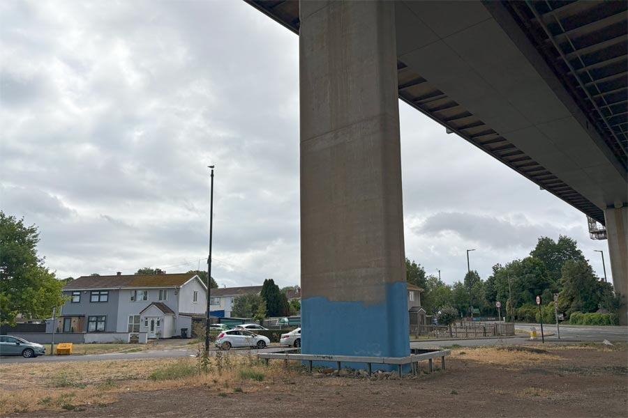
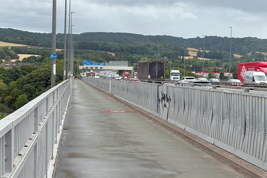
Relaxed and with my thirst quenched I walked on through the back street until I came to where the monstrous M5 Bridge soared over the rooftops of the town and the River Avon. I climbed the long ramp of the footpath/cycle path and at the top was immediately assaulted by the roar of eight lanes of fast moving traffic thundering across the bridge. I looked to my left and down through the railings where I could see the back gardens of houses with their patios, garden sheds, children's swings and trampolines. There was a very strong headwind to walk against and the combined noise of the wind and the traffic was astounding. Luckily I had some earplugs in my rucksack for use when sleeping in noisy places so I dug them out.
 |
 |
| Under the M5 bridge | On the M5 bridge |
At the other side of the Avon it was a relief to descend from the bridge. I sheltered in the tunnel beneath the roadway during a brief downpour and then walked on into the more peaceful countryside. It was quite peaceful, but not quite countryside, because soon the path passed along the edge of the Royal Portbury Docks. On my left were trees and countryside, but on my right was a high wire fence topped with barbed wire, lights and CCTV cameras. This fence continued on for about 2 miles and behind most of it were acres of tarmac and hundreds of new cars all neatly parked in long rows. They had been imported by sea and were destined for delivery all over the country.
The path returned to the banks of the Severn Estuary and then passed through a low lying area of grass and towards the town of Portished now visible ahead. The grass was only about a foot high but the heads had been bent over the narrow track by the wind and were softly brushing against the bottom of my walking trousers. I could see that the legs of my trousers were getting a little wet but I continued on. The after a short while I felt that my feet were getting wet too. I stopped to investigate, then realised that the seed heads of the grasses were absolutely laden with water which had been soaking through the bottom of my trousers legs and running into my boots. I then veered left to get out of the grass and on to higher ground where I then found the path that I should have taken. I continued along this and into the town. As I walked through Portishead Marina it started to rain heavily so I wasn't able to stop to look around. I headed for the nearest bus stop and took the next bus back to Bristol. I sat upstairs on the bus and took my boots off during the journey in an attempt to dry my socks.
 |
| The wrong track to Portished |
End of day 1: About 14.5 miles walked today.
Day 2 - Portishead to Clevedon.
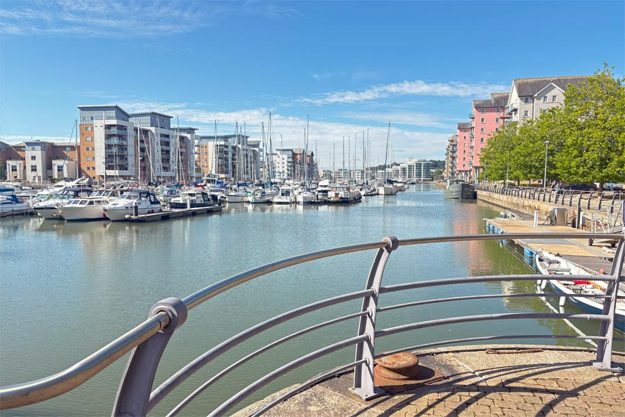 |
 |
| Portishead Marina | Portishead Point |
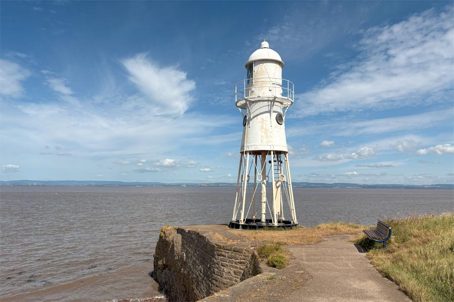
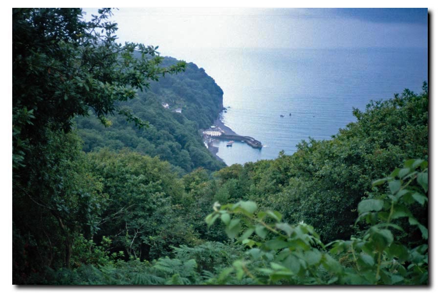
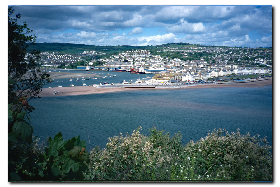
Next day I returned by bus to Portishead. It was a much nicer day so I strolled in the warm sun to the sea-lock end of the marina where I stopped for a coffee and a swirly pastry. I watched the huge lock being operated for a while and then continued on towards the old pier, past the lifeboat station, through the woods and on to Battery Point and Portishead Point lighthouse. There followed about six of miles of rough track at the very edge of the river bank, sometimes narrow, sometimes lined with overgrown bushes. As I approached Clevedon it became a paved path on the landward side of a row of houses and lead to Clevedon promenade.
 |
 |
 |
 |
| Clevedon Pier | Clevedon promenade |
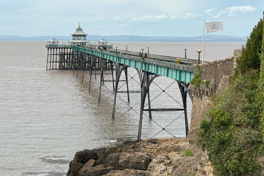
The afternoon was hot and there was little breeze and I only cooled down after reaching the Clevedon promenade where there was a breeze. If walking south, as I was, Clevedon Pier can only be seen properly after having walked past it.
 |
 |
| Clevedon seawater pool | View from Wain's Hill |
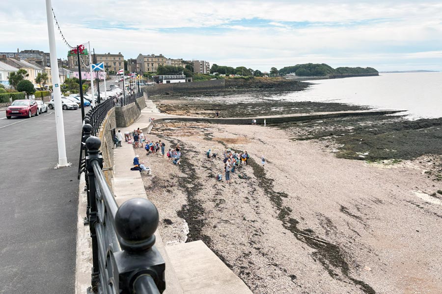
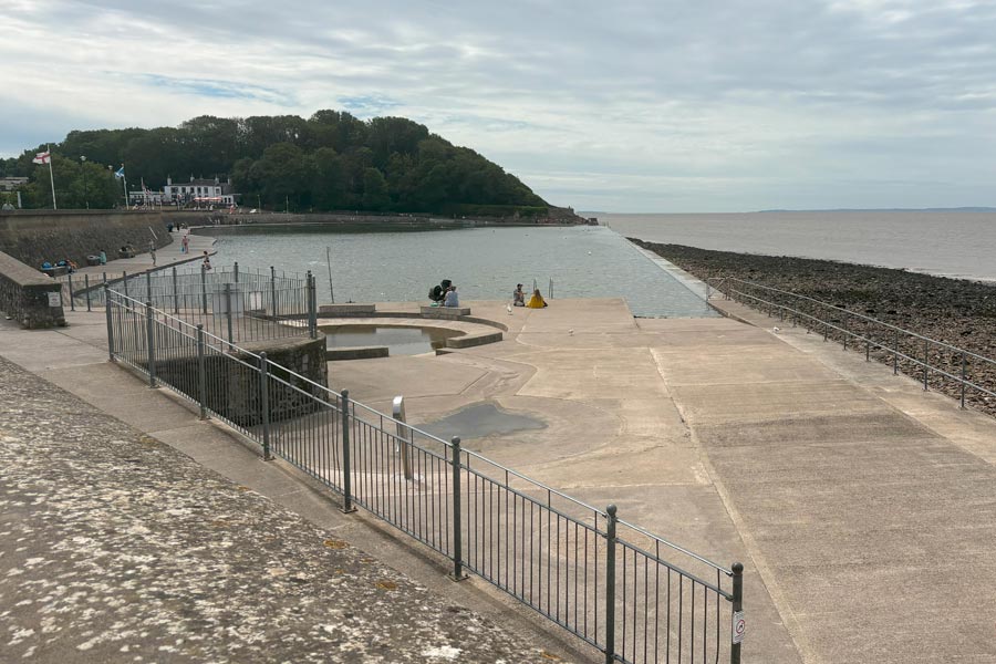
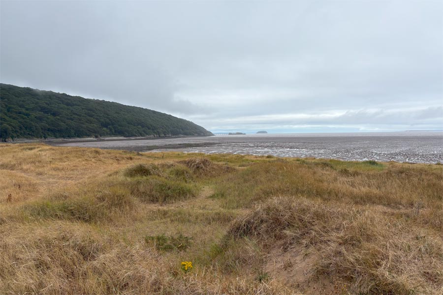
Further along the promenade is the Clevedon seawater swimming pool and beyond that the ground rises up to Wain's Hill where there is a view over the mud flats at the mouth of the Blind Yeo and the levels beyond. Which was as far as I could go on the England Coast Path*. After an half-hour rest, lying in the sun on the grassy area on top of the hill I returned to the town where I caught a bus to Bristol.
End of day 2: About 23 miles walked in two days.
*Path
At the time of writing this (2025) the England Coast Path from this Wain's Hill to Sand Bay near Weston Super Mare does not yet exist and no coastal pathways exist on the Ordnance Survey map. Apparently there are matters such as rights of way and wildlife protection areas to be taken into consideration before the final route can be decided. I hope to be walking that section as soon as the route has been finalised. It would be about a 9 or 10 mile walk if an inland route along existing lanes and tracks was taken, but I hope that the chosen route will be as close to the coast as possible.
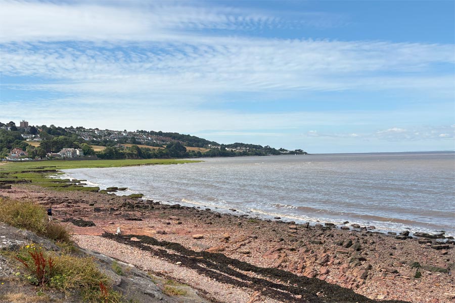
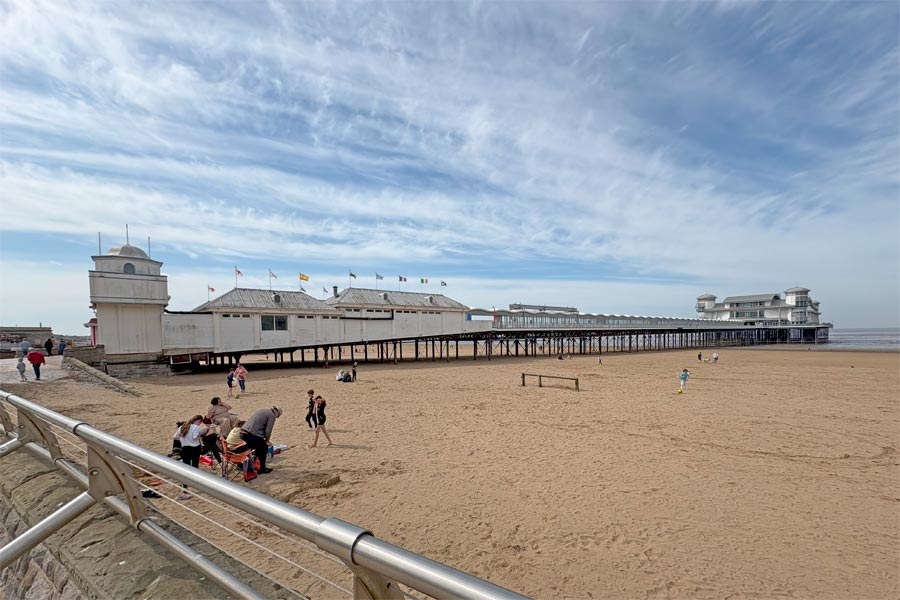
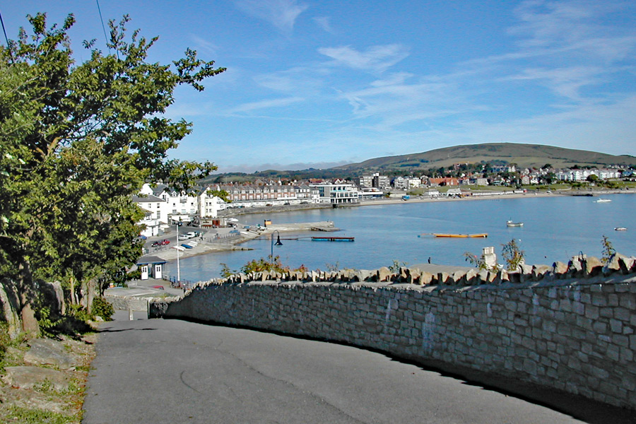
Sand Bay, Weston Super Mare, Brean, Berrow, Burnham-on-Sea, Highbridge, Bridgewater, Hinkley Point, Watchet, Blue Anchor, Minehead.
Day 1, Morning - Sand Bay to Weston Super Mare Pier
Because I was passing near Weston on my way home I decided to spend the morning doing this short walk then continue the walk from Weston Super Mare to Minehead at a later date.
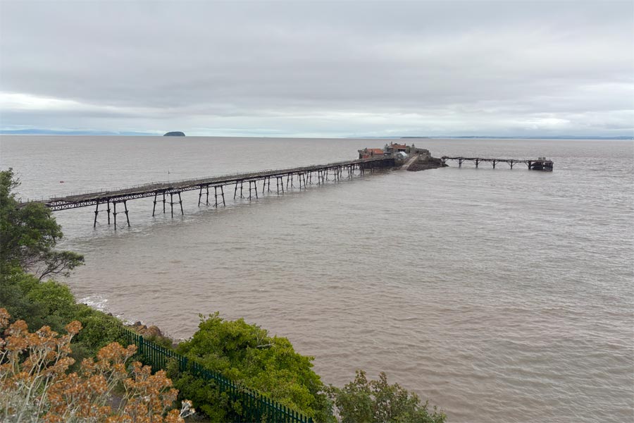
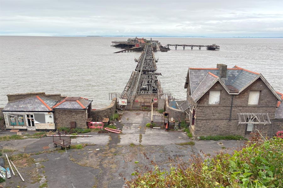
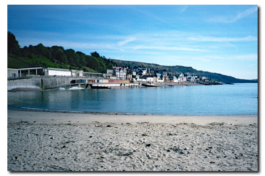
I parked in central Weston and took the number 1 local bus from Weston's Grand Pier to Sand Bay. It was a breezy and cloudy morning. At Sand Bay the start of the ECP was near the bus terminus. It followed the concrete path running south along the top of the sand dunes between the beach and the road. Birnbeck Island, which is at the end of the Birnbeck pier, and Steep Holm island were just visible on the horizon beyond Whorlebury Hill, which jutted out into the estuary. On reaching the end of the dunes the path crossed the Weston road and then entered the woods that covered the hill. It proceeded along a wide and pleasant woodland path which gave glimpses of the estuary through the trees to the right. At the headland near Birnbeck Pier the path emerged from the trees, re-crossed the road and dropped down below the road level to the car park near the now derelict Birnbeck pier. Here I stopped to look at and photograph the sad remains of the derelict structure. Most of Birnbeck island was submerged by the incoming tide with just the pier remaining. I walked down the steps at the end of the car park to the walkway and came to a cafe, where I stopped for coffee, and later continued along the walkway passing the Weston seawater bathing pool and along the promenade to arrive back at the Grand Pier late that morning. I drove home that afternoon.
 |
 |
| Whorlebury Hill ahead | Birnbeck Island Pier |
 |
 |
| Birnbeck pier | Weston seawater pool |

About 4 miles walked this morning.
Day 1: Afternoon - Weston Super Mare Pier to Highbridge
This afternoon walk was on a different day to the previous morning walk but I have recorded both as one day of walking. It was a late start that day due to several delays on my train journey from Dorset to Weston Super Mare. For this walk had I pre-booked accommodation for three nights and took a bivvy bag and sleeping bag for the night that I was unable to book.
 |
 |
| Weston-Super-Mare | Uphill and Steep Holm Island |
 |
 |
| Brean Down | Berrow, Low Lighthouse (1832). |
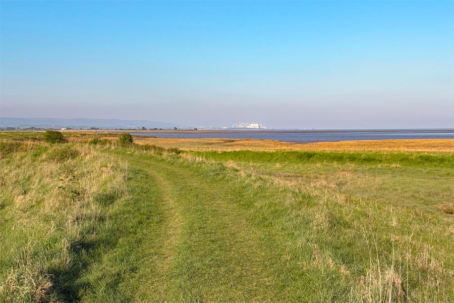
The sun was warm but there was a cold wind blowing from the east so I kept my fleece on for most of the day. Usually after about half an hour of walking I am down to my tee shirt or light top but today there was a stiff and rather cold wind. The walk along Weston beach to Uphill was easy on the firm, damp sand. At the end of Weston Bay the River Axe has to be crossed, necessitating a 4 mile detour inland to cross at Brean Cross Sluice. The path the goes to Brean Down, which is a continuation of the Mendip Hills extending out into the Bristol Channel. At certain parts of the year it is possible to walk back along the other side of the Axe to arrive Brean Down but at other times this is not allowed due to the risk of disturbing the wild life. At those times it is necessary to follow the road from Brean Cross Sluice to Brean Village and then walk back to Brean Down. I didn't walk out onto the down that day due to lack of time caused by my late arrival in Weston but I had walked it previously. From Brean I walked along the beach to Burnham. The tide was out and although it was a little misty I could make out the North Somerset coastline and the Quantock Hills on the other side of Bridgwater Bay, which was where I intended be in two days. At Burnham the path leaves the beach. Here I stopped at the Reeds Arms, where, on the terrace and sheltered from the wind by glass panels, I sat in the sun for a while with a pint, before I walking inland to Highbridge where my accommodation was.
About 12 miles walked this afternoon. Walking via Brean Down today would have added another 6 miles.
End of day 1: About 16.5 miles walked (over two half days).
Day 2 - Highbridge to Bridgwater
 |
 |
| The River Brue | The River Parrett |

The weather was the same as yesterday, sunny but with a cold easterly wind. I walked out of Highbridge, which included walking along some narrow alleyways sandwiched between rusty corrugated iron sheets on one side and a high fence on the other. Luckily some of the sheets had collapsed away from the path, making walking easier but in some places it was almost too narrow for me to squeeze through. I then crossed the River Brue and began to walk back to Bridgwater Bay. I was soon walking out of sight of houses and roads. There was a steady wind but it was peaceful and there was no one else around. I arrived at the mouth of the River Parrett after about 2 miles and looked across to Steart Point, half a mile away on the other side of the river. From here I had about 11.5 miles of meandering riverbank to walk inland before reaching the bridge that was the first possible crossing of the river. The first 8 miles or so were peaceful and uninhabited, then the path passed through industrial and residential areas. On reaching the bridge crossing the Parrett I continued on into the town for another mile to my accommodation for the night.
End of day 2: About 13 miles walked today outdoors, and half a mile indoors?*
*Indoors?
OK, that was a slight exaggeration, but my hotel seemed to have evolved from at least three different old buildings, each with floors at different levels. My room must have been in the furthest building for I was given my key but not instructed as to how to get there as I was assured that I would need help. I was shown the way. Up the wide staircase, along the passage to a little glass door, a sharp turn to the right then down some narrow stairs, through another glass door, a change of direction along another narrow passage, through another door, up some narrow stairs, along a very narrow passage, then... I will stop there because I have already gone wrong. I know that there were more stairs and changes of direction before getting to my room but I have forgotten them too. Anyway, my room was at the end of a little corridor. I was amazed to find that I was able to find my way back to reception with out any problem when I went out for meal and a pint in town. But I had a little trouble finding my way back later that evening. (This was not due to drink.)
Day 3 - Bridgwater to Hinkley Point
 |
 |
| Returning along the Parrett to the Bristol Channel | The Bristol Channel near Steart Point |
 |
 |
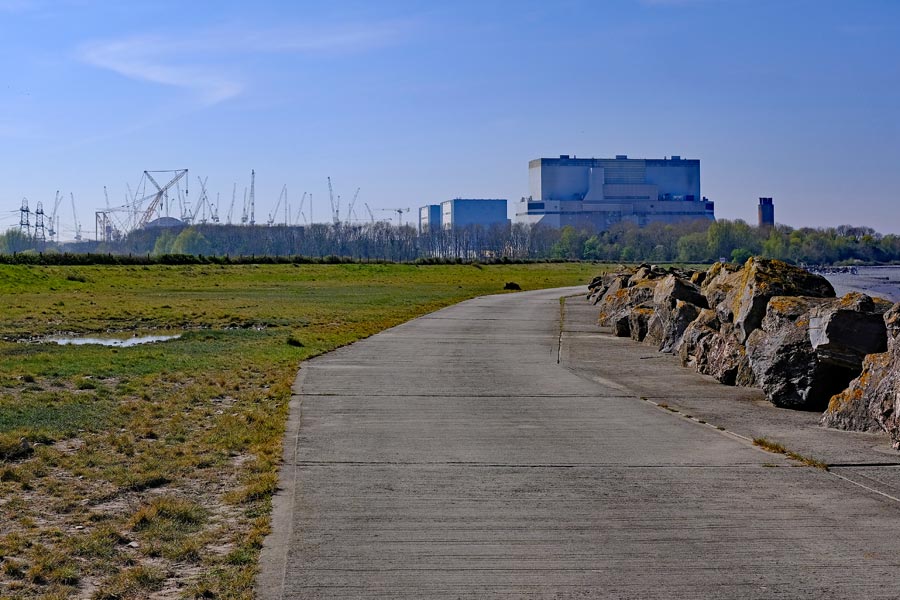
| Hinkley Point A and B | Hinkley Point C site |
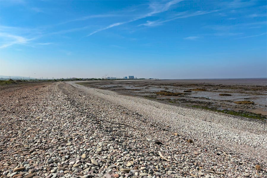
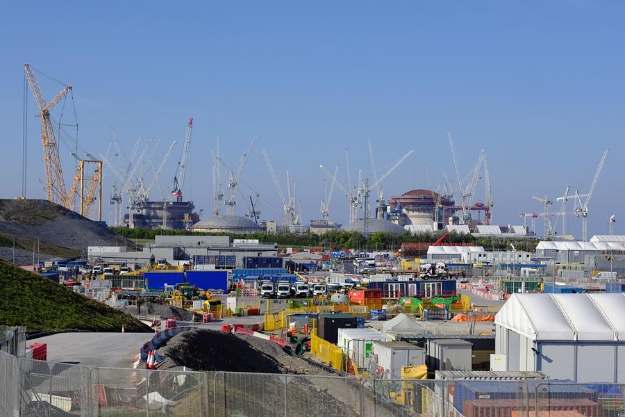
It was sunny again but there was still that cold wind blowing across the exposed flats as I walked along the other bank of the River Parrett for another 12 miles to get back to Bridgwater bay. I enjoyed the quiet walk along the banks of the Parrett and then the banks of the Bristol Channel and after another 5 miles I arrived at the site of the three Hinkley Point nuclear power stations. I knew that the coast path was closed here due to the building of the Hinkley Point C station next to the previous two now obsolete stations. I followed the designated diversion*.
*Diversion
Here I was appalled find myself directed along a very narrow strip of land with long grass hiding the very uneven ground. There was a high fence on the right hand side of the narrow path with overgrown trees and bushes pressing up against it, and a steep sided unfenced water-filled ditch very close to the left hand side of the path. At the end of the path I crossed the immaculate tarmac road to the site, busy with heavy traffic passing backwards and forwards to and from the site including white buses every few minutes with just a few workers in each. Soon the signage pointed me towards rough ground again but this time it was too waterlogged to walk on, so I had to walk on a narrow, uneven raised grass verge close to the heavy traffic before reaching the sudden start of a wide footpath from nowhere. On seeing the immaculate infrastructure for the traffic I wondered why a little more thought had not been taken to provide a safer diversion for public footpath walkers.
 |
 |
| Excavated rock and earth | Sunset over the Channel |
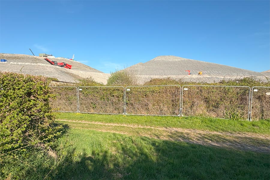
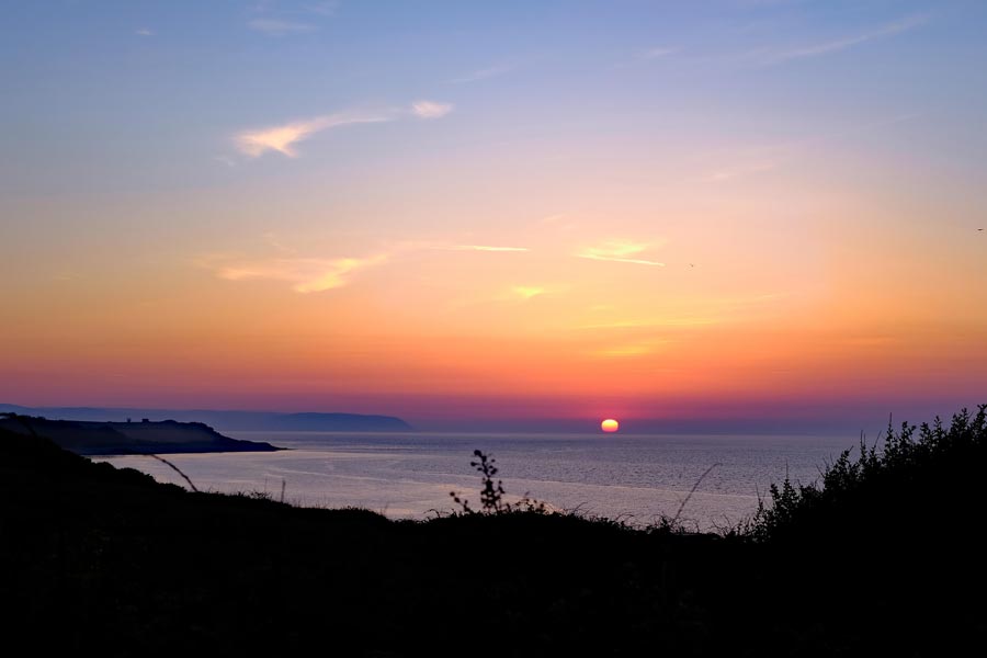
As I walked the three miles of the diversion around the construction site and back towards the coast, I passed the immense heaps of rock and earth that had been excavated during the building work. There were large machines moving about on these massive man made hills but they looked like tiny Tonka toys. Apparently 5.6 million cubic meters of rock and around 4 million cubic meters of earth had been excavated to contain the new power station.
I had been unable to get accommodation for this part of the walk so I bivvied for the night in a sheltered spot out of the wind, overlooking Bridgewater Bay. It was a clear night with an almost full moon but the brighter stars could still be seen. It was cold. Much colder than I had expected. I lay there gazing up at a sprinkling of stars and passing satellites, but it was just too cold to sleep. Then, after almost two hours I remembered that I had an emergency space-blanket in my rucksack. With this wrapped around me as well I was warm enough to sleep.
End of day 3: About 18 miles walked today.
Day 4 - Hinkley Point to Watchet
 |
 |
 |
 |
 |
 |
| Approaching Watchet | Watchet Harbour |
This stretch of coast had some very interesting natural features, with rock pools and other fascinating rock formations on the beaches. The coast path is along the beach at St Audrie's Bay which cannot be used during high tides and there is no alternative safe route for walkers. The tide was low when I walked through. Some of the stone ledges and layers of rock were slippery with seaweed so I was very careful where I trod. Some of the layers of rock look as if they were remnants of some huge man-made road of giant cobbles. I spent the night in a hotel at Quantock Head, which was inland a little. When booking my accommodation for the night I had viewed what was on offer on-line and had chosen a hotel in Watchet, but then I clicked on the wrong hotel and booked it. Unfortunately I had not chosen the slightly more expensive cancelable booking option so I was committed to stopping short of Watchet and trekking inland to the hotel.
End pf day 4: About 9 miles walked.
Day 5 - Watchet to Minehead
 |
 |
| Approaching Minehead | The start of the SWCP |
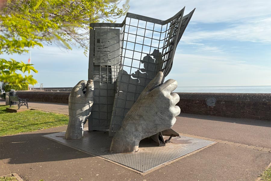
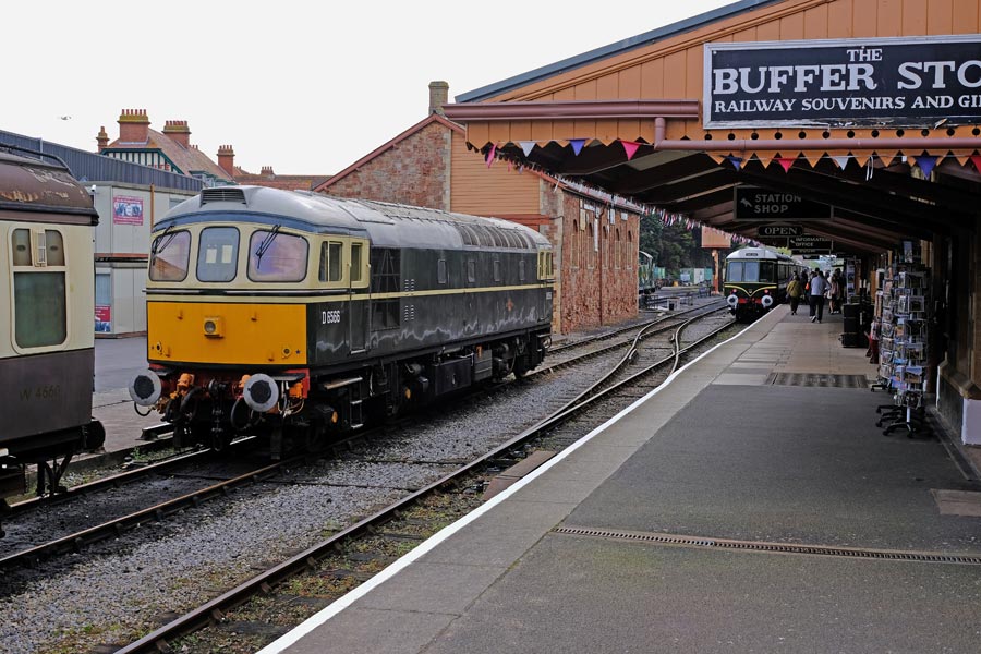
Returning to the coast, the path then runs along the beach at Helwell Bay which again cannot be used during high tides and again there is no alternative safe route for walkers. More slippery rocks too. After Watchet the path rises and falls over the hills and through woodlands then finally drops down to run along the footpath path above the beach alongside of the B3191 for a little less that a mile to Blue Anchor where it then leaves the road and runs along the pathway behind the shore. After about 2 miles it runs along the front of some wooden chalets that look out over Blue Anchor bay. After about 3 miles Minhead beach is reached. The clouds rolled in as I walked along the front and arrived at the metal sculpture denoting the start of the South West Coast Path. When I was last here, in 1999, there was only a small brown sign near the Red Lion Hotel saying (incorrectly) "Coast Path to Poole 500 miles". I had a quick look at Minehead Railway Station, now the terminus and headquarters of the West Somerset Railway. There were no trains due but there was a bus due so I took it to Taunton, and then a train home to Dorset.
End of day 5: About 8 miles walked today.
A total of 64 miles in four and a half days from Sand Bay.
A total of 87 miles in six and a half days from Aust.
I completed this walk before the walk to Minehead detailed above. Back then I used four National Trail Guides, one at a time, to aid me. I made a few notes in the margins of the books as I walked and years later when I built this website I used those notes to aid my memory, along with the slide photos that I took at the time using small 35mm film cameras. I now wish that I had written more notes at the time, and taken more photos.
I had walked the Cotswold Way long distance path before attempting the SWCP so I already had a rucksack, walking boots, walking socks, walking trousers, and wet weather gear. I stayed in pre-booked accommodation for that walk. But for the SWCP walk I decided to take a one-man tent, a sleeping bag and an inflatable mattress to give me more flexibility over where to stop.


Olympus XA and Olympus mju2
The photographs of most of my South West Coast Path walk were taken on Olympus compact 35mm film cameras loaded with Agfa CT200 slide film. So I never knew if my photos were any good until about a week after getting home from each walk. Some were thrown away and some have been lost so I have chosen the best of what were left. The slides were scanned on a Nikon Coolscan V.
Minehead, Porlock Weir, Lynmouth, Lynton, Combe Martin, Ilfracombe, Morteho, Woolacombe, Croyde, Saunton, Braunton, Barnstaple.
Day 1. Minehead to Yeanor Wood.
I took a train to Taunton and then a bus to Minehead and arrived at lunchtime. The sign for the start of the SWCP at Minehead was near the Red Lion so I had a pint there before I started. Oddly, the little signpost indicated "Poole 500 miles". I had forgotten that, until I read my notes again. I know that my trail guide said 613 miles. Straight away the path started to ascend and then zigzag and soon I was high above the sea. It was overcast but I was exhilarated to finally be walking the coast path. It veered inland for a while, then dropped to near sea level at Porlock bay and then climbed to Hurlstone Point before dropping down to Bossington, skirting the edge of coastal marshes and by-passing the town of Porlock. At Porlock Weir the path followed the road for a short while then climbed towards Yearnor Wood. As I continued on began to realise that the walking was more strenuous than I had expected or perhaps I was carrying too much gear? Tired, I camped that evening on a scrap of flat ground in the Wood.End of day 1. About 10 miles walked. No photos survived.
Day 2. Yeanor Wood to Lynmouth.
The next day began with a trek through the woods that covered the top of the cliffs, so I could hear the sea but could only glimpse it now and then. After about a mile of easy going I came to Culbone where there was an ancient and tiny church in the combe. I stopped to have a look. It was tiny all right. As I continued on through Culbone Wood it became misty and started to rain. After about seven miles of wet woods I finally came out into open ground and headed towards Foreland Point. By that time my waterproof jacket had started to get wet inside. The sun came out again and at Lynmouth Bay I detoured inland to the White Horse Inn at Countisbury for a pint. (I don't think it's there now.) As I walked on it started to rain again and by the time I got to Lynmouth I was soaked; the waterproofing on my jacket had failed. I booked into the Rock House Hotel, dried out and went to look for a replacement jacket. There was only one suitable shop in Lynmouth, which was where I bought the only suitable jacket, which was heavier than I wanted, and more expensive. I had just blown most of my budget on a hotel room and a new jacket! |
 |
| Lynmouth, late afternoon. | Lynmouth to Lynton Cliff Railway |
Day 3. Lynmouth to Combe Martin.
After a good night's sleep and a good breakfast I walked as far as the Lynmouth to Lynton Cliff Railway which I chose to use (as suggested by my trail guide) instead climbing the zigzag cliff path. I then walked past Castle Rock and into the valley of the rocks. It was warm and humid but there were a few showers. The path turned inland towards the first bridge that crossed the River Heddon but I continued inland for another half mile to reach The Hunters Inn where I was looking forward to a pint and some lunch. The sun was shining by then. I hurried, as it was getting late for lunch. It was 13:45 when I got there but it was closed and there was no indication as to why. Disapointed I returned to the coast. I was beginning to find it hard going again. The narrow, sunken and very muddy path down to Combe Martin was tricky and I had to take care not to slip. I walked on through the village to my campsite for the night at Newberry Farm.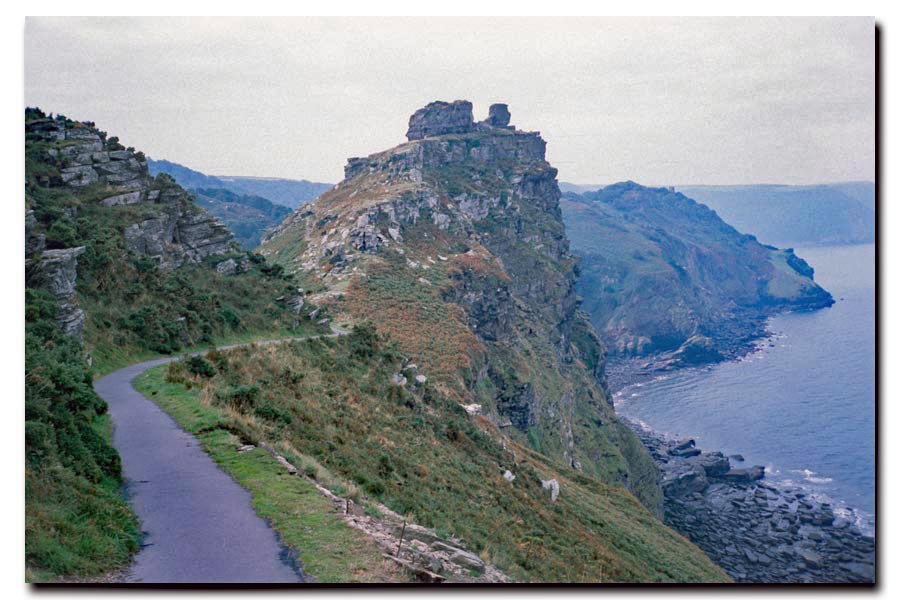 |
 |
| Castle Rock just beyond Lynmouth. | On the Great Hangman above Combe Martin. |
End of day 3. About 15 miles walked today.
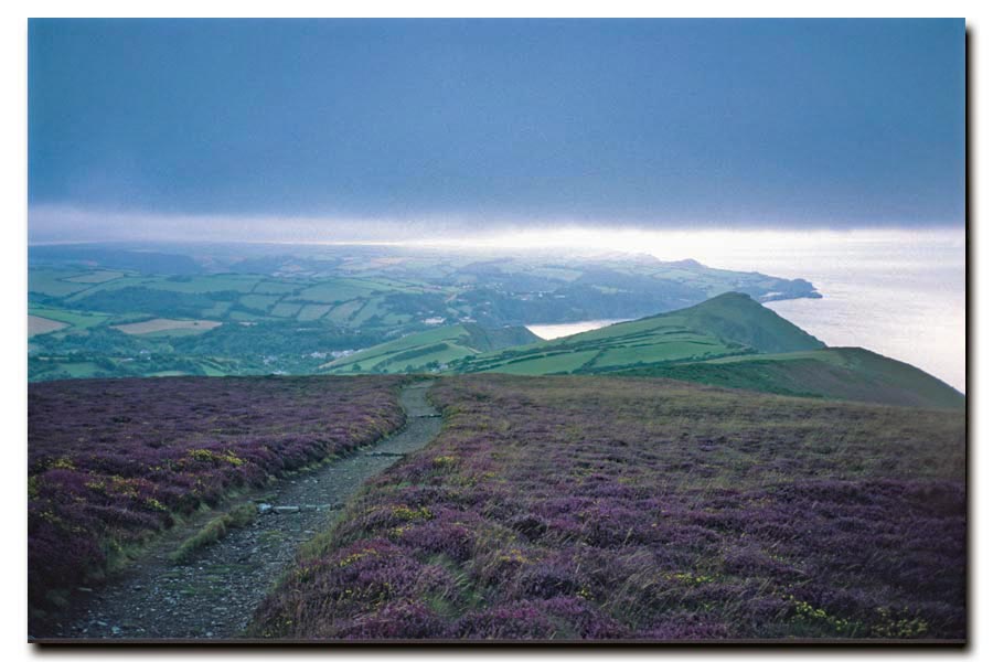
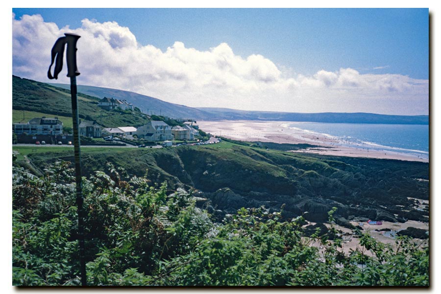
Day 4. Combe Martin to Ilfracombe.
Next day was cold, windy and wet. The path wasn't particularly strenuous but I still found it hard going. By the time I got to Ilfracombe I was becoming convinced that was carrying too much, but there was nothing I could do about it. I was determined to get to Barnstaple. I had only walked a few miles that morning but I was worn out. I went straight to the Ilfracombe Tourist Information Bureau to find a room for the night. I got a reasonably inexpensive room at the Seven Hills Hotel. Not much budget left now, but I was able to take it easy for the rest of the day. Later I went to the George and Dragon for a couple of pints and a meal, where I watched the Ilfracombe Carnival Procession go past. I then had an early night.End of day 4. About 6 miles walked. Only a half day's walking today.
Day 5. Ilfracombe to Braunton.
 |
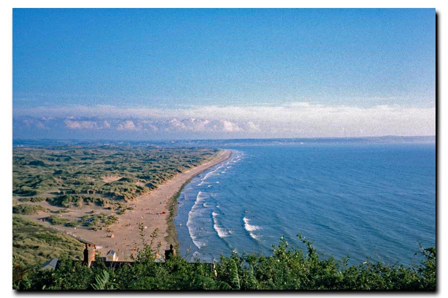 |
| Morte Bay ahead. | Saunton Sands and Braunton Burrows. |
End of day 5. About 19 miles walked today.
Day 6. Braunton to Barnstaple.
Next morning I walked along the banks of the River Taw to Barnstaple and had a wander around the town. I had lived there for a time when I was an apprentice*. I went to find The Golden Fleece, my first regular pub, but it was gone. Demolished. So I went to The Three Tuns, another pub that I remember, and had a pint there before catching a train home.On reflection I decided that, even though I began to find the walking a little easier as I approached the end, I would probably not take any camping gear on the next walk, which was to be Barnstaple to Newquay. I also suffered from a few blisters, which I attributed to having damp, sweaty feet on the hot days.
End of day 6. About 8 miles walked today.
About 67 miles of walking the SWCP so far, counted as 5 days. (Four whole days plus a half day at each end.)
*Apprentice
I was an apprentice electrician with the CEGB (Central Electricity Generating Board), a job that had chosen when I was sixteen mainly because it gave me the chance to leave home. I spent ten months at the CEGB training school near Barnstaple with other apprentices from power stations all over the South West of England. We then returned several times every year for a month at a time for the next three years to study at the North Devon Technical College in Barnstaple. The Golden Fleece was the pub that I and my small group of apprentice friends regularly frequented during our college months, playing the pin-ball machine and drinking brown splits, until we got banned for being too noisy. We then moved on to The Three Tuns where we behaved a little better I like to think.
Barnstaple to Newquay 2000
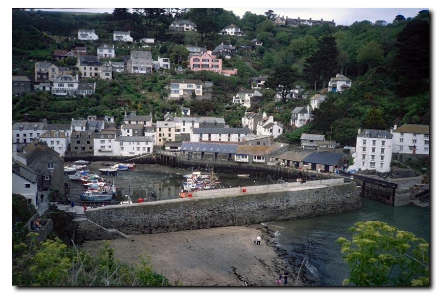
Barnstaple, Instow, ferry to Appledore, Westward Ho!, Clovelly, Hartland Quay, Morwenstow, Bude, Widemouth Bay, Cracklington Haven, Boscastle, Tintagel, Port Gaverne, Port Isaac, Port Quin, Polzeath, Trebetherick, Rock, ferry to Padstow, Trevone, Portcothan, Trenance, Newquay.
When walking from Minehead to Barnstaple last year I overloaded myself with camping gear, so for this year I pre-booked my accommodation in advance. My rucksack was lighter now and I had nothing strapped to it. I just hoped that my estimates of the length of each day's walk were accurate. Also I had abandoned my polished leather walking boots and had bought a pair of lighter fabric boots with Goretex lining, hoping that they would help to keep my feet better ventilated.
I went by train to from Taunton to Barnstaple. I waited for the Taunton train and was surprised to see that it was a small diesel multiple marked "Tarka Line Jazz Train" on the side. On board, at the front of the first carriage was a four piece jazz band, a small bar and a collection of beer casks. I had a pint of Piston Bitter while enjoying the music and watching the countryside go by. I stayed at The Cresta Guest House on Sticklepath Hill, not far from the station, (B&B £25 en-suite). That evening I strolled up the Hill and had a pint or two in the Wrey Arms, another pub I remember from my youth as an apprentice. I attended block release courses at the nearby the North Devon Technical College until I was nineteen.
Day 1. Barnstaple to Buck Mills.
I started out early that day after collecting the packed lunch that I had requested instead of a breakfast. I could not have started out so early if I had waited for breakfast. I walked back to the railway station, where I joined the SWCP, which followed the footpath built on what used to be the railway line from Barnstaple to Bideford. It was also part of the Tarka Trail and ran near the River Taw for a short time. On the way I passed close by the site of the demolished East Yelland Power Station and the separate ,building that was once the CEGB Basic Training Workshop where I trained as an apprentice for ten months when I was 16. All that was left of the power station was a huge hole in ground and piles of blackened rubble. The training building was still there but it had been turned into small business premises.
I followed the trail through Marsh Barton and at Instow I took the ferry across to Appledore. By doing this I missed out the alternative route across the Bideford Long Bridge and through Bideford town. I walked through Appledore and walked around the edge of the North Burrows Country park and arrived at Westward Ho! where I stopped for to eat my packed lunch. It had been sunny and showery so far but as I walked on the rain was getting heavier and the path was becoming more challenging with constant ascents and descents from cliff top to almost sea level and back again. My accommodation for the night was at The Old Mill Tea Room (B&B £19) at Buck Mills. I dined on 'canned beer and a toastie' it says in my notes.
 |
 |
| Clovelly harbour through the trees. | Cliffs near Hartland. |
End of day 1. About 17 miles walked.
Day 2. Buck Mills to Hartland Quay.
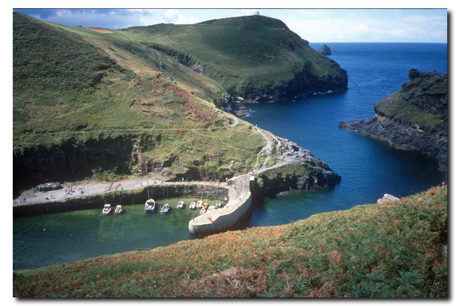
Next morning it was raining as I walked through about 6 miles of woods, part of which was along The Hobby Drive, a stony drive, but slippery. By the time I got to Clovelly the rain had stopped. I walked down the steep cobbled street to the village and had tea and a scone at The New Inn. I went down to look at the harbour then climbed back up through the village. There was a little more walking through woodlands before breaking out into open countryside and about 7 miles of ups and downs to get to Hartland Point, where I stopped for a break and a sandwich overlooking the lighthouse. After another 3 miles I arrived at Hartland Quay where I had booked a single room at the Hartland Quay Inn. That evening I had a couple of pints of Stella with a tuna sandwich and chips in the Wreckers Retreat Bar.
End of day 2. About 16 miles walked.
Day 3. Hartland Quay to Bude.
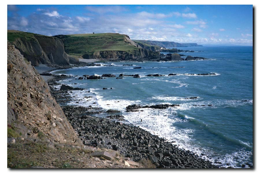
Next day there was a wet and another strenuous* 6 mile walk to Marsland Mouth which is the border between Devon and Cornwall then about 2 miles to Morwenstow where I had a pint of Duchy and a snack at The Bush.
*Strenuous
I wasn't enjoying the many steep descents from the cliff tops down almost to sea level and the steep climbs back up to the top of the next cliff. But I did enjoy the spring in my step and the feeling of lightness that occurred when reaching a stretch of reasonably flat walking. I also enjoyed the fact that I was often the only person around for as far as I could see. I realised there and then that those particular feelings were what were going to get me to the end of this walk as I knew that whenever I was struggling, those feelings were going to be enjoyed again and again many times ahead of me.
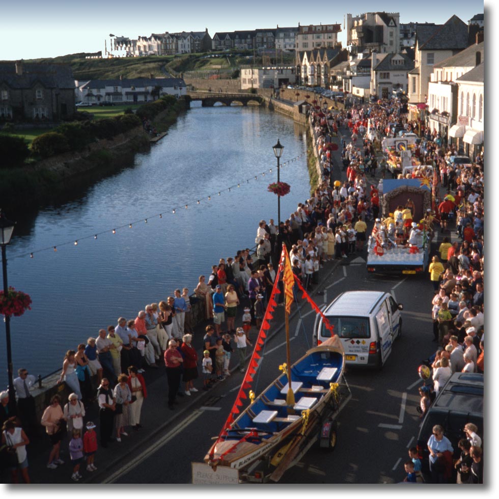
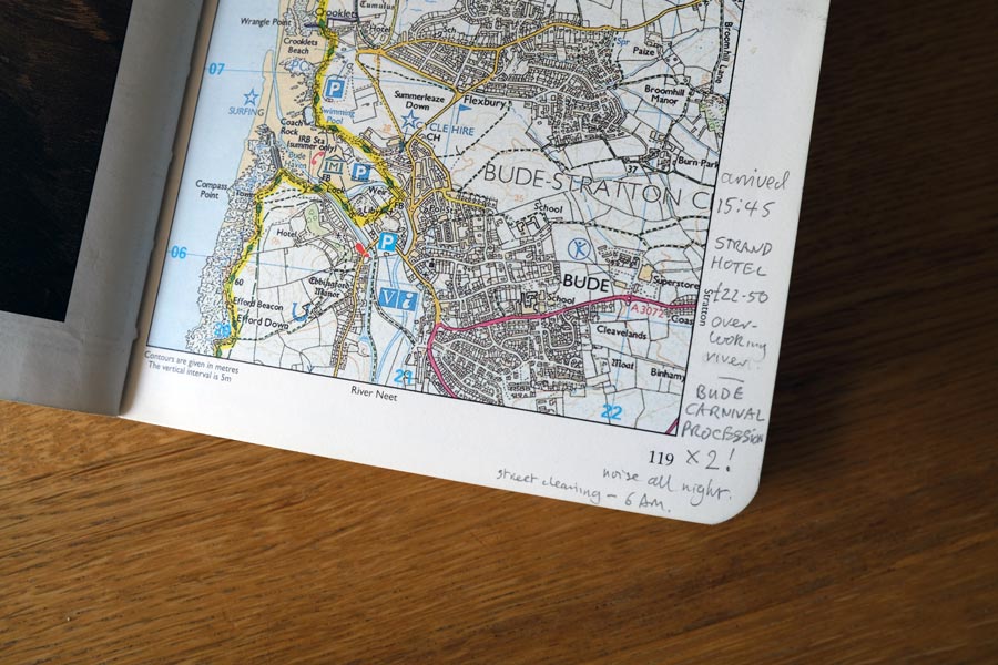
Then the sun had appeared and next was a strenuous but sunny 7 mile walk to Bude, where I had booked a room at The Strand Hotel. Later, from my room overlooking the River Neet, I watched the carnival procession. Shortly afterwards I watched it go back the other way. The sound of people enjoying themselves could be heard for much of then night so I didn't get to sleep very early. Then at 6am the street cleaners began.
End of day 3. About 15 miles walked.
Day 4. Bude to Tintagel.
For my walk to Cracklington Haven the next day, the notes that I made in the margin of my trail guide are a bit sparse, so I guess that I had nothing much to mention other than 'tered' 'cool wind' 'rugged' 'steep' 'sunny' and 'busy beach'. Here I stayed in the Combe Martin Inn (£25).
The notes for following day's walk are better and include 'pasty for lunch' 'very breezy - needed my fleece' and 'tough'. There was a steep climb down to Boscastle and its interesting little harbour. Where I bought the pasty, which I ate shortly afterwards when back on the cliffs. Notes for the walk to Tintagel just say 'cold wind, sun and cloud'. In Tintagel after dropping my rucksack off at the B&B (£18 en-suite) I wandered into town but was too late to visit the ruins of Tintagel Castle. I bought a copy of the 'National Trail Guide for Padstow to Falmouth' in King Arthur's Bookshop as my existing guide only went as far as Padstow and took in some nourishment at King Arthur's Inn where I also sampled Cornish Insurrection, Doom Bar and Hicks Bitter.
 |
 |
| Boscastle Harbour. | Padstow Harbour. |
End of day 4. About 12 miles walked.
Day 5. Tintagel to Padstow.
Next day, It was a hard 20 mile walk from Tintagel through Port Isaac, Port Quin and Polzeath to the River Camel near Rock where I took the ferry across to Padstow. I was the only passenger. My B&B in the town centre took some time to find. I trudged around until I finally found Mrs Dann's B&B*.
*Mrs Dann's B&B
There was a notice on the door: "Ring the bell and wait at least two minutes. Don't ring again. My feet won't get there any quicker". Another notice said: "No en-suite rooms. No TV in the rooms. No single rooms - you will have to pay extra".
When I told Mrs Dann that I wanted to leave at 7 am the next morning, she told me that I was "leaving too early for breakfast" and that I "still had to pay full price". I asked about a packed lunch instead and she told me "I don't do packed lunches". I was worn out and needed to rest, so I paid up. Later that evening I went out for a drink and fish and chips. Not at Rick Stein's though; too expensive.
End of day 5. About 20 miles walked.
Day 6. Padstow to Newquay.
Next day the walk to Newquay was uneventful, apparently. I must have been getting used to the terrain as there is no mention of it in my notes, just the weather: 'cool and windy'. I found my accommodation, St Bernard's Guest House, and later went to The Central for a couple of pints of Hicks Daylight Robbery. Very nice. I also remember that it was a cold evening and I was amazed at the number of radiant gas heaters that were attempting to heat the outside area at the front of the bar. Next day I took a train home. Back to work on Monday!
Newquay
End of day 6. About 23 miles walked.
End of Barnstaple to Newquay. About 103 miles walked in 6 days.
Total South West Coast Path walked so far: 170 miles in 11 days
Newquay to Falmouth 2001
Newquay, Holywell, Perranporth, St Agnes, Porthtowan, Portreath, Gwithian, Hayle, Carbis Bay, St Ives, Sennen Cove, (Lands End), Porthgwarra, (Minack Theatre), Porthcurno, Lamorna, Mousehole, Newlyn, Penzance, Marazion, (St Michael's Mount), Praa Sands, Porthleven, Gunwalloe, Mullion Cove, Lizard, (Lizard Point), Cadgwith, Coverack, Helford, ferry to Helford Passaage, Maenporth, Falmouth.
I pre-booked my accommodation again for this walk.
I took the train to Newquay the day before and stayed at the St Bernard's Hotel.
Day 1. Newquay to St Agnes.
Light winds and sunny. Not far out of town it was necessary to cross the Gannel, which flows out at Crantock Beach. There were several crossing options outlined in my guide book but I was able to use the low tidal bridge and cross the low salt marsh beyond. Apparently there was also a ferry at high tide and two higher bridges more inland for use at higher tides. There were then a few headlands to cross, punctuated by walks along Holywell Beach and Perran Beach, both large unspoiled beaches. I was at Peranporth by 12:30 where I bought cheese rolls for lunch and a pasty for later.
The walk to St Agnes was easier, being mostly along the cliff tops, and I arrived at my B&B (£16) at about 4:30. There was a qualifying match for the World Cup on the TV in Porter's Ale House and there was a hen party there too so it was quite noisy, especially as the final score was England 5 Germany 1!
End of day 1. About 16 miles walked today.
Perran Beach
Day 2. St Agnes to Gwithian
Apart from two steep descents and ascents in quick succession and another at Porthtowan, the path was again mostly along the side of the cliffs and hills where the ground was sloping* down towards the sea.
*Sloping
Walking the coast path required a lot of walking on ground that sloped down to the right, and I mused as to whether it would be a good sketch for TV's 'The Two Ronnies': as walkers, with them, the end of a long trek, ending up with one leg longer than the other and only able to walk in circles! Just a thought. Back to reality.
Next was Portreath where the path was more cliff top walking and past the disused airfield there. Approaching Gwithian the path droped down to the beach where it reverted to the road to cross the marshes there. My stop for the night was at Gwithian where I arrived at 4:30 just before the rain started. Gwithian house, suite of rooms! £25. I had a pint or two of Tribute at the Pendennis Arms that evening.
End of day 2. About 16 miles walked today.
Day 3. Gwithian to St Ives
Next day it was back to the beach, walking the 'rather difficult path' at the edge of the sand dunes, as described in my margin notes. I think that the tide must have been in at the time as I would have chosen to walk on firm damp sand nearer the sea if there had been any. Back on firm ground later, the path turned inland along the estuary to Hale where it looped through two arches of the long railway viaduct that bisects the town, then it skirted the estuary before returning to the sea. Here the path ran alongside the branch line to St Ives. I had lunch at Carbis Bay and arrived at St Ives at 2pm where booked in to my B&B, which had a nice view over the rooftops to the harbour. I then had a good look around the town. Margin notes say: Pizza; The Castle inn; Cornish Knocker; Figgys Brew; The Union Inn. Which I had where I don't remember.
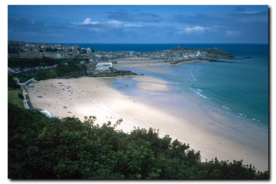
St Ives
End of day 3. About 16 miles walked today.
Day 4. St Ives to St Just
Next morning was a windy and overcast and I found the path quite challenging, but a little later the sun appeared enhancing the spectacular coastline. There were also interesting features like very disturbed land, old chimneys, derelict buildings and mine shafts that were fenced off.
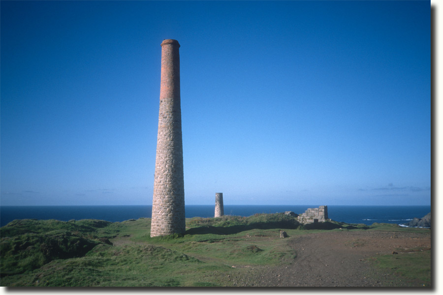 |
 |
| Mine chimneys | Derelict buildings |
End of day 4. About 18 rather strenuous miles walked today.
Day 5. St Just to Lamorna Cove
I had breakfast in the dining room with a squad of Marines that were doing a training exercise in the area. I was out walking by about 8am. I found the path still tough going but after walking through Sennen Cove towards Land's End the path became wider and then became surfaced with tarmac. There were also a lot of people walking in both directions. Very few with rucksacks though. I didn't stay long at Land's End. I was disappointed*.
*Disappointed
I found that the Land's End Experience 'Theme Park' was a collection of noisy and gaudy amusements and concessions that I thought were completely out of place in such a wild and previously unspoiled place. I only took one photo as I approached and didn't take any more. I was only taking photos of the most interesting, spectacular or memorable places and in those days I tried take photos without people in them, so I didn't want to waste my film on a busy eyesore. But I did notice that the children seemed to be enjoying it.
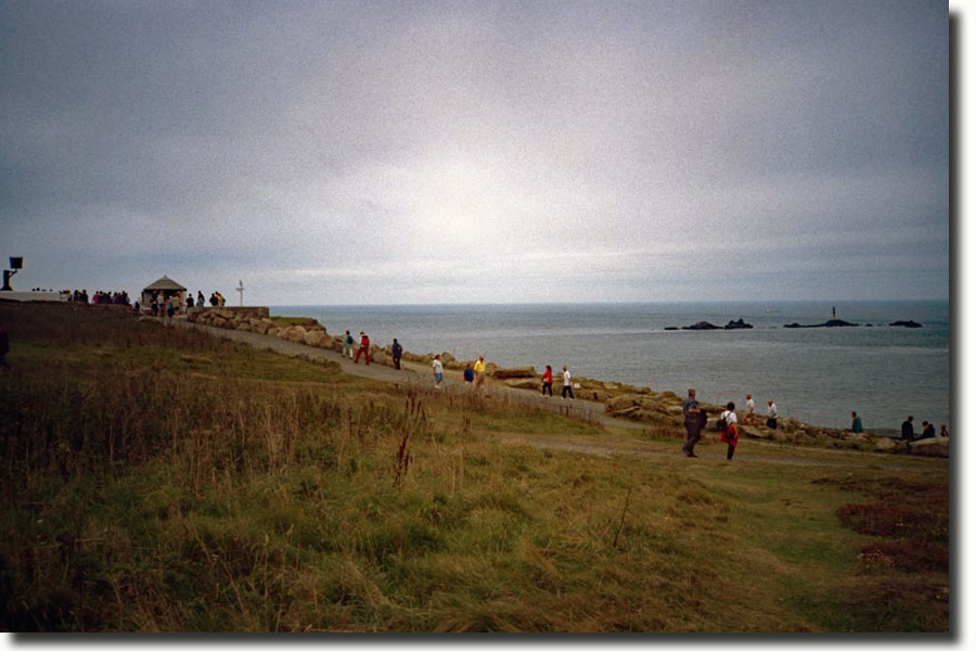
Approaching Land End
After a time there were less people out walking the path, which diminished in width and ease of walking. After about 4 miles I came to the Minack Theatre, a place that I had heard about but I had not realised that I would be passing it. I went in to have a look and sat on one of the terraced seats for a rest and to eat my lunch. I could imagine how it good it could have been on a summer's evening watching a production there with the sea as the background. I continued on, soon with the path to myself again, to Lamorna Cove where I stopped for the night. Here I stayed in a cosy little cabin next to the stream that flows through the wooded valley to the sea. I went to The Lamorna Wink for a pint. There was football on the telly, England V Albania, 2-0.
End of day 5. About 17 miles walked pwimages/18landsend.jpgtoday.
Day 6. Lamorna Cove to Porthleven
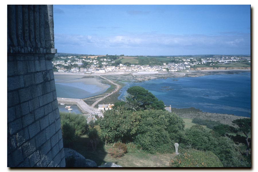
After Lamorna there was a bit of civilisation to walk through. So I passed through Mousehole, Newlyn and Penzance without taking much notice or writing any notes. I was more interested in the more remote stretches and didn't linger long in the towns that I passed through. (Nowadays I quite like a walk along the sea fronts of such towns.) I also passed through Marazion with it's spectacular views of the bay and St Michael's Mount. My next stop was at Porthleven, where I paid a whacking £35 for a room at the Harbour Inn.
End of day 6. About 19 miles walked today.
Day 7. Porthleven to Lizard
The going was definitely getting easier. It says so in my notes. The path continued along the cliffs, across the Loe Bar and on towards Mullion Cove and several other coves, where the path was a little less gentle, before becoming easier again. At Lizard Point I turned inland to my accommodation at Lizard. I stayed at The Top House B&B £23.
 |
 |
| Mullion Cove | Approaching Lizard Point. |
End of day 7. About 13 miles walked today.
Here I had a break from walking. I took a bus to Penzance to meet my wife who had journeyed down by train. She had hired a car and booked a hotel so we spent a few days visiting memorable local places of interest like Mullion Cove, The Lizard, Marazion and St Michaels Mount. We also went to Land's End and showed her the The Land's End Experience which was memorable for a different reason.
 |
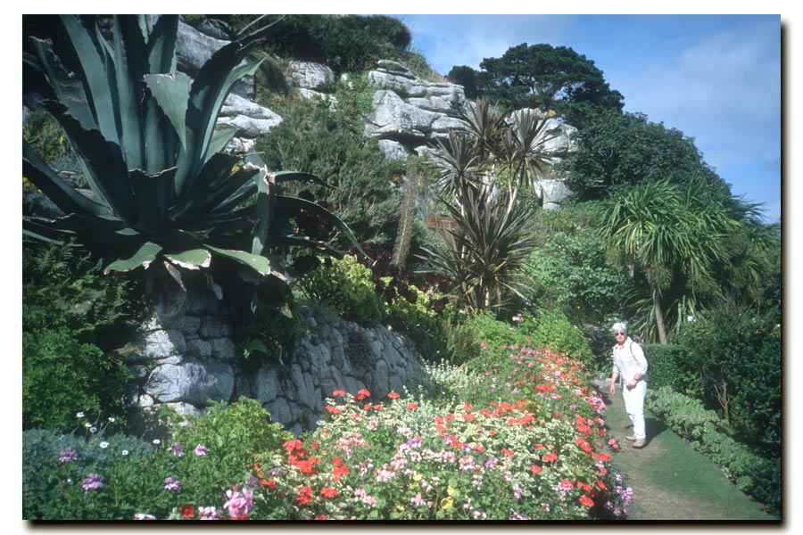 |
| St Michaels Mount | St Michaels Mount |
Day 8. Lizard to Coverack
I was dropped of at Lizard by my wife. It was then a hot, sunny and quite a tough walk to Cadgwith and then Coverack, where I stayed at The Paris Hotel. It had been a hot day with almost no wind so after a quick shower I went to the bar for a pint. It was very busy in the bar, and the only beer they had left was Boddingtons. As I waited for my pint realised that something was going on. Everyone went silent and watching the television* behind the bar.
*Television
I then saw pictures of an airliner crashing into The World Trade Centre in New York. It was late afternoon, Tuesday 11th September. What I saw didn't register with me for a moment. I first though that it was a terrible accident, but as I watched the pictures and listened to the reports of the atrocities committed that day I found out that it was something far worse. I remember asking for another pint later but by then they had completely run out of beer. I don't remember if I had another drink. I think that I just went for a walk.
End of day 8. About 11 miles walked today.
Day 9. Coverack to Falmouth
I had a disturbed night's sleep and started walking again in a bit of a trance. I could not get the pictures of what I saw yesterday out of my head. Ordinarily, when starting out, I would be enjoying the early morning pleasures of walking along an almost deserted stretch of beautiful coastline, but today I didn't want to enjoy myself. I didn't seem right when there were so many that had just died and many others that were still suffering. I had originally intended to end this walk at Plymouth, but after walking only a few miles I decided to walk to Falmouth and catch the next train home.
I missed out the headlands at Nare Point and Dennis head and walked along country lanes to get to Helford quicker and in time for the next ferry. I took no photographs and made no notes. I arrived at Falmouth at about 4pm and caught to 4:40 to Truro and then onwards to home.
End of day 9. About 22 miles walked today.
End of Newquay to Falmouth: About 148 miles walked in 9 days.
Total South West Coast Path walked so far: 318 miles in 20 days
Falmouth to Plymouth 2002
Falmouth, ferry to St Mawes, ferry to Place, Portscatho, Portloe, Gorran Haven, Mevagissey, St Austel, Par, Fowey, ferry to Polruan, Polperro, Looe, Seaton, Downderry, Portwrinkle, Kingsand, Cremyll, ferry to Plymouth.
I pre-booked my accommodation again for this walk.
Day 1. Falmouth to Portloe
I returned to Falmouth by train and stayed the night in The Maenheere Hotel. I had a pint at The Cork and Bottle and The Grapes. I was up early next day, keen to be walking, but I slipped up. It was a Sunday and the ferry to St Mawes didn't start running until 10am. I wandered about the town and spotted where the ferry was moored up. I went to buy a pasty and returned to sit in the sun and wait. A chap came along at 10am, jumped onto the ferry and prepared to set off. I stood up and waited for the signal to board, but suddenly he cast-off! I shouted that I wanted to ride and he said "jump on then". By then there was a small gap which I just about got across, teetering on the edge of the boat for a split second. He seemed to ignore me and I was quite annoyed to think that I might have ended up in the water with a heavy pack on my back. But I didn't say anything. He then steered the boat round to another part of the waterfront where a small queue of people were waiting and where he moored up again and they began to board. I then realised that I had been waiting in the wrong place! When they were all aboard, he took the fares, I paid mine and said meekly "thank you" and off we went.
At St Mawes I then took the 11am ferry across to Place. After about 5 miles of walking I was at Portscatho, where I sat on the beach in the sun and ate my pasty. I like to buy proper traditional pasties when out walking; the ones with a big crust on one side; they taste just as good cold and can survive being stuffed in a rucksack better. After lunch I walked about 3 miles to Pendower beach where I had a snooze in the sun. After another 5 miles I arrived in Portloe where I had a B&B booked. I had an evening in the Ship Inn which included fish and chips and where I met fellow walker Bob, who I came across in several pubs on this stretch of coast. We had a nice evening talking about walking and about Bath, where we both lived near. I asked Bob if he preferred to walk alone*, which he did and which I was pleased to hear.
*Alone
A short walk with others can be a nice experience, chatting and comparing experiences, but there can come a time when the conversation dries up and there are still several hours of walking to do. In the end people sometimes start taking about pointless and trivial things just to break the silence. Then they start to mention anything nearby, even obvious things. "Oh, the sun has just come out again", or "Oh, there's a squirrel's and he's burying a nut". To which you say "I hope he can find it again", immediately wishing that you hadn't said something so pathetic, and thinking "did I really just say that?"
 |
 |
| Falmouth to St Mawes ferry | Porthcurnick Beach and Nare Head |
End of day 1. About 13 miles walked today.
Day 2. Portloe to Mevagissey
 |
 |
| Leaving Portloe | Veryan Bay |
Leaving Portloe there was a rough sea and driving rain as I walked round Veryan Bay to Dodman Point. As I approached the rain stopped and it began to brighten up. After rounding the point there was a little more shelter from the wind. Just after Turbot point there were some grey seals down on the beach but they were too far away to see properly. The path was still quite strenuous, as it had been for much of Cornwall so far, but I only had to walk about 12 miles that day to get to my accommodation at Mevagissey. I stayed at Mount Pleasant House and had a meal at The Ship Inn with Bob and where he later introduced me to John and Elizabeth, who were also walking the path.

Mevagissey
End of day 2. About 12 miles walked today.
Day 3. Mevagissey to Par
There were plenty more ups and downs after leaving Mevagissey, then a slightly easier walk inland and around the edge of the caravan park at Pentewen before ascending and hugging the edges of the cliffs again. The path then goes out to Black Head and back again. The path became hard work shortly afterwards, but after Charlestown and its interesting harbour the path got easier. At Par it was an easy walk through a very dusty and grey industrial estate with high wire fences on both sides of the path to get to my B&B (£15), which overlooked the A3082 and a holiday park with Par Sands beyond. I had a stroll on the beach and then went for a pint at The Welcome Home Inn in Polmer, which was on my next-day route. No food there, so I backtracked and went into Par, which I found to be a bit scruffy, where I had steak pie and mash at The Ship Inn.
End of day 3. About 11 miles walked today.
Day 4. Par to Polperro
Next day it was overcast but bright as I past Polmear again and on to the picturesque village of Polkerris, which was at the bottom of yet another steep-sided valley to descend and ascend. The first one of the day. The next feature was the Gribbin Tower on Gribben Head where there is an option to keep to the path or venture down the front of the head for a bit of extra and steeper walking. I don't remember which way I chose but I did take a photo there. At Polridmouth, just behind the second beach there was a lake where the path crosses a bridge. Say 'Pridmuth' when mentioning it.
 |
 |
| Gribben Head | Lantic Bay Pencarrow Head |
About 2 more miles and I was at Fowey, where I bought a pasty. My favourite lunch when walking. Did I already mention that? After taking the ferry to Polruan, I walked through the narrow streets and at the top of the hill, near the lookout station, I stopped to eat my pasty, which was still warm. Lovely. After Pencarrow Head the sun appeared and I had a hot 6 mile walk, during which I had to apply some factor 25, to Polperro where my B&B was (expensive - £35). The evening was at spent at The Three Pilchards and with Bob again, and John and Elizabeth came in later.
Polperro
End of day 4. About 13 miles walked today.
Day 5. Polperro to Portwrinkle
End of day 5. About 12 very wet miles walked today.
Day 6. Portwrinkle to Plymouth (13)
I came back to Portwrinkle on much nicer day when my wife and I happened to be staying in Plymouth. I only carried a daysack containing waterproofs and sandwiches, so it was a pleasant walk to Rame Head, then to Kingsand where I had a pint at The Cross Keys. Later there was a little rain and I was at Cremyl at 4:15pm where I took the ferry back to Plymouth.

Cremyll ferry to Plymouth.
End of day 6. About 13 miles walked today.
Falmouth to Plymouth: About 74 miles walked. 5 days.
Total South West Coast Path so far: about 392 miles. 26 days.
Plymouth to Lyme Regis 2003
Plymouth, ferry to Mount Batten, Wembury, ferry to Noss Mayo, (low-tide wading across River Erme), Bigbury on Sea, ferry to Bantham, Hope, Salcombe, ferry to East Portlemouth, Torcross, Stoke Fleming, Dartmouth, ferry to Kingswear, Brixham, Paignton, Torquay, Teignmouth, Dawlish, Starcross, ferry to Exmouth, Budleigh Salterton, Sidmouth, Beer, Seaton, Lyme Regis.
I decided not to pre-book any accommodation for this walk. During the last few walks there were several times when I had to keep going to get to my accommodation and a few times when I wanted to keep going but had to stop because I had already got there. This time I took a light sleeping bag and a bivvy bag in case I could not find anywhere to stay or did not want to sleep indoors. This journey required a little researching as it required the use of several ferries and the occasion of a low tide at one point.
Day 1. Plymouth to the Rive Erme.
I traveled to Plymouth by train. There was a group of Americans in the carriage, but unusually I didn't hear them until the train stopped at a station, where I caught part of a conversation about beer. "We had some nice beers" one of them began, "Carl something and John Smith, and Tennants in Scotland, but we had Budweiser in London", to which another said "was that the real Budweiser or the American version?" I assume alluding to the fact that Budweiser originated in Budweis in what is now the Czech Republic in 1265 and is not the same beer as the similar style beer first brewed in America in 1876. I didn't hear the rest of the conversation because the train was picking up speed again. I arrived in Plymouth at lunchtime and started walking at 1pm.
The going was easy and I was at Warren Point by 4pm. The ferry was out of order and a rowing boat was being used to cross the River Yealm. After that, most of the going was easy and I reached the River Erme by 8:30pm. Here there was a river crossing or a 'not recommended' 9 mile walk along narrow country lanes to cross at Sequer's Bridge as there are no public paths along the river. The river here can only be crossed during the one hour ether side of low tide and the next low tide was at 4:30am the next day. I reconnoitered the river crossing while it was still light and then settled down in my bivvy for the night.
I'm a bit short of photos for this day.
End of day 1. About 15 miles walked today.
Day 2. The Erme estuary to Outer Hope
I awoke at 4am and quickly packed my bivvy. There was light rain during the night so it would need to be packed properly later after drying it. It was still quite dark but I knew in which direction the slope out of the river was on the other side, so with no boots, socks or trousers I headed for it. The water was well above my knees at one point and it pushed me around a little but when I reached the other side I found that I had arrived downstream of where I wanted to be. Ahead of me was just a muddy bank. Rather that trying to push my way back upstream I decided to climb it and found that as well as being very muddy, higher up there were nettles, after which was a barbed wire fence. I could not retreat down the muddy slope so I continued on, painfully. In the field beyond I dried out and got dressed before finding my way to the path onwards.
It was an overcast start. There was some strenuous walking to get to Bigbury-on-sea and I was there at 8am and getting hungry. Unfortunately for me the shop and the cafe were closed until 9am. I had a full-English at 9am. I was at the next river crossing, just over a mile away at the River Avon at Bantham at 10:15am. The ferry only operated 10am-11am and 3pm-4pm. I stood opposite the large thatched house and waved - as instructed, and was taken across. As I continued on, the sun appeared and the walking got easier.
Because of my early start I was at Outer Hope by about 1pm and had a pint of Plymouth Pride at The Hope and Anchor, where I decided to find some accommodation, dry out my bivvy bag, wash away the mud and relax. I booked into the Sand Pebbles Hotel and relaxed later at The Hope and Anchor again.
End of day 2. About 9 miles walked today.
 |
 |
| Approaching Bigbury-on-Sea. | Approaching Hope Cove. |
Day 3. Outer Hope to Salcombe
The next stretch I marked as "strenuous" in my guide book. I think that it must have been one of those days that I was not at my best for I only walked 8 miles to Salcombe. I arrived early afternoon, stopping for an hour in the sun at South Sands before walking into the town. I had a pint at The Ferry Inn*, which overlooks the river.
*The Ferry Inn
I chatted with the Barmaid as she pulled several large jugs of ale from the beer tap and poured them straight down the sink before starting to pull a pint for me. She asked me where I was from. When I told her "near Bath" she said "Bath is nice," then, "so is Clitheroe," adding "that's up north too."
I went to the Tourist Information Centre and got accommodation at Limericks, Raleigh Road (B&B £25), which had a view of the river over the rooftops. Later I went to Captain Flint's restaurant, where I noticed that they had a Long John Silver's Revenge pizza (spicy sausage, chilies and garlic) but it was too busy and too noisy for me, so I went to The Fortesque Inn and had cod and chips and Bank's Bitter.
End of day 3. About 8 miles walked today. Lazy or what?
 |
 |
| Salcombe. | Start Point ahead. |
Day 4. Salcombe to Torcross.
After a trip across the river on the ferry to Portlemouth, I found the path to Prawle Point and Start Point to be strenuous. After that the going became easier. From Start Point I could see the line of beaches stretching along the coast from Hallsands, Beesands and Slapton Sands to Blackpool Sands. Approaching Hallsands I passed the ruins of the old village that was lost to the sea. All that are left now are two ruined buildings of the thirty seven that were once there. It's an interesting and shameful story that you might like to read about. If so, search for "Hallsands disaster". At Beesands I passed "The Cricket Inn" (it must have been closed) and headed for Torcross, which is at the start of Slapton Sands. There I got a room for the night in a B&B right on the seafront. I had a stroll around the Slapton Ley (pronounced Lee apparently) Nature Reserve, which is a long freshwater lake behind the beach, before going for meal and a pint in the "Start Bay Inn".
 |
 |
| From Start Point. | Torcross. |
End of day 4. About 13 miles walked today.
Day 5. Torcross to Dartmouth
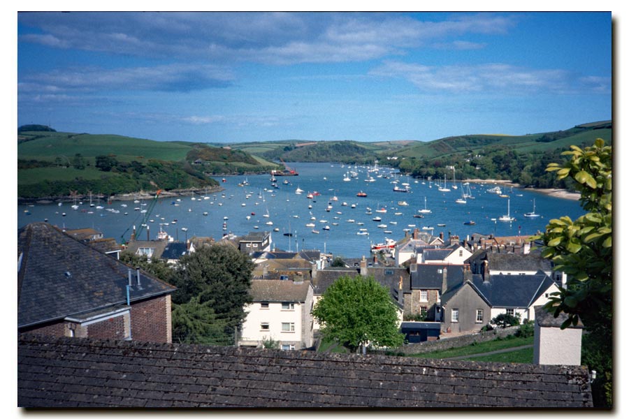
From Torcross the path which ran alongside of the road behind the beach. It ran close to the road until the end of the Ley where the road turned left and the path continued straight on across countryside. It rejoined the road to pass through the village of Strete and didn't stray far from it until after passing through Stoke Fleming, where, after about a mile it returned to the coast. After about 3 miles I was at Dartmouth Castle where I stopped for lunch. In my notes it says 'Devon pasty'. It was mid afternoon so I strolled into town and got a room for the night at Sunny Banks B&B. I spent the evening in The Windjammer and sampled Dartmoor IPA and Jail Ale from Princetown Breweries. I like to sample local brews.
End of day 5. About 10 miles walked today.
Day 6. Dartmouth to Torquay
I started out a 9am after a good breakfast, 'very hot breakfast' it says in my notes, and took the ferry across to Kingswear. There had been a cold wind blowing and some sun yesterday but today the cold wind was still thee plus showers as I rounded Inner Forward Point. I found the next section very demanding. A steep drop to Scabbacombe Sands and then several very steep climbs, all during heavy rain. I had to walk in waterproofs so I became wet with perspiration. But I would have been a lot wetter without them. Because I get hot very quickly when wearing waterproofs I had started to carry a small fold-up umbrella, which allowed me to walk through the rain in light clothing, but it was too windy to use it that day. I also found that umbrella to be very handy when caught in an unexpected downpour. I could whip it out of my rucksack pocket in seconds instead of getting soaked while trying to get into my waterproofs. What I need to do next is to perfect the ability to get into waterproofs while holding an umbrella!
By the time I had reached Brixham the sun had started to appear but there was still the odd shower. I had a quick lunch at the harbour and continued on. My guidebook mentioned the alternative of then taking a bus or using a shuttle ferry to miss out the near-urban walking to Torquay, but I wanted to see everything on foot, and I could see that the going was much easier on that stretch so I kept walking. The weather was improving and I had a short rest on Paignton beach and arrived in Torquay at about 5pm where got a room at the Newlyn Hotel.
Paignton
End of day 6. About 19 miles walked today. Very hard at first then very easy.
Day 7. Torquay to Exmouth
I didn't stop to look around Torquay and was soon descending the zig zag path down to Babbacombe beach and then taking the steep zig zag road up again. After the easy walk through Paignton and Torquay front I found the walk to Teignmouth quite strenuous, judging by the frequent use of the abbreviation 'stren' written in my guidebook. However the path then ran alongside of the Penzance to Paddington railway line and this made it very easy walking, apart from two excursion inland where there were railway tunnels. Back alongside of the railway the going through Dawlish and Dawlish Warren to Starcross was easy and also very interesting, if you like experiencing fast trains thundering by very close. At Starcross I took the 4pm ferry to Exmouth. I stayed at The Sheldon Guest House and during a short wander around the town that evening I had a pint of Brooklyn Bitter at The Powder Monkey.
Teignmouth ahead
End of day 7. About 18 miles walked today.
Day 8. Exmouth to Seaton
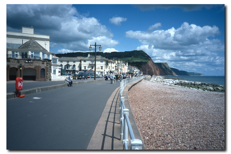
From my notes (because I don't remember): I was walking by 8am and after about 2 hours of moderately easy cliff top walking arrived at Budleigh Salternon where had a full breakfast overlooking the beach, so I must have declined breakfast at the guest house in order to get an early start. There was a short excursion inland to cross the River Otter and at 12:30 I had arrived at Ladram Bay. The path had became a cliff top walk again and was strenuous until dropping down to the sea front at Sidmouth, where I stopped at The Marlborough Hotel for a pint of Abbot at 14:00. From Sidmouth the path became very strenuous, if not severe, for a time then back to strenuous, passing through Beer and arriving at Seaton. The weather had been good and there was going to be a clear sky that night so that evening I had a meal and a pint or two (my notes don't mention where), and at dusk I walked out of town and onto the cliff where I found a secluded spot just off the path and settled down in my bivvy bag to watch the stars until I fell asleep.
 |
 |
| The Jurassic Coast. | Sidmouth |
End of day 8. About 23 miles walked today.
Day 9. Seaton to Lyme Regis
 |
 |
| Early morning Lyme Regis. | Breakfast in Lyme Regis. |
I woke early and I think that I had half a packet of biscuits and a swig of water before starting out. Soon I was walking through the trees in the undercliff, a long strip of land that had slumped from the cliff to come to rest nearer to the sea. It was densely wooded with few views of the sea and needed care owing to its rugged and uneven nature. After 6 miles of undergrowth and twisty path I arrived at the east beach of Lyme Regis. I walked into the town and found a cafe with a view of the sea where at about 9am I had a full English breakfast. A smashing end to my walk. I spent the rest of the day on buses. A number 31 Lyme to Axminster then 30 via Chard and Ilminster to Taunton then a 337 to Bristol and 332 to Bath. I enjoyed that too.
End of day 9. About 7 miles walked that morning.
Plymouth to Lyme Regis: About 122 miles walked. 9 days.
Total South West Coast Path so far: 537 miles. 37 days.

Lyme Regis to South Haven Point 2004-2005
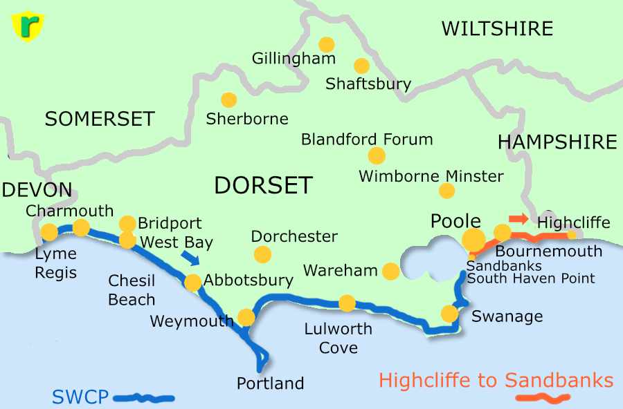
Lyme Regis, Charmouth, Seatown, West Bay, Abbotsbury, (Chesil Beach), Weymouth, Osmington Mills, (Durdle Dor), West Lulworth, Swanage, Studland, South Haven Point.
This section was partly rewritten in 2025 so I have added some recent details concerning diversions. It may be of more use than my previous accounts of weather, pasties and pubs!

The photographs in this final part of my South West Coast Path walk were taken on a Nikon E775 camera. This was my first digital camera. I chose it because it was as small and as light, although a little bit chunkier, than the compact 35mm film cameras that I had been using up to then. Also it was relatively inexpensive. Early digital cameras were very expensive. It had a modest 2.1 megapixel sensor, an optical zoom lens and an optical viewfinder.
I didn't need accommodation for this walk because by then I had retired and moved to West Dorset. So I was able to take buses to and from the start and finish points or get my wife to drive me.
Day 1: Lyme Regis to West Bay
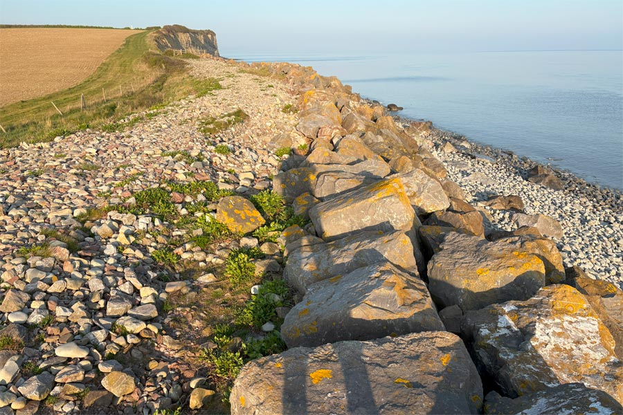
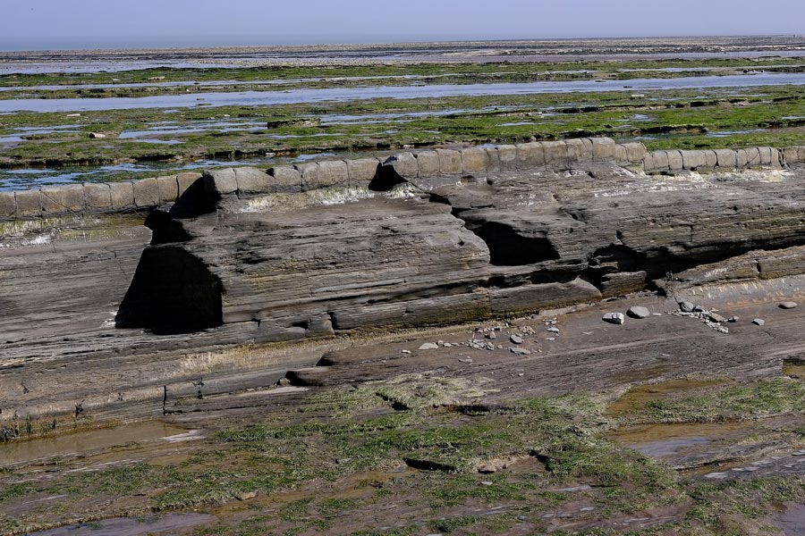
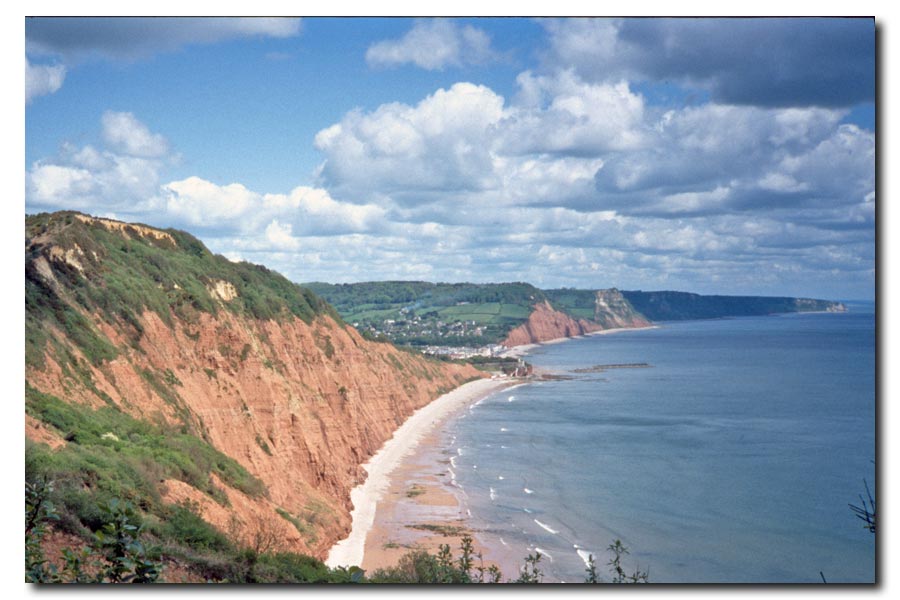
The terrain of Dorset is similar to that of East Devon. The hills are green and rounded except at the coast where the edges have been sliced off by erosion and washed away by the sea. The most obvious coastal features in East Devon are the red sandstone cliffs of the Triassic period. From Lyme Regis they become the dark grey clays and shale of the Jurassic period and are loaded with fossils. Because of erosion, the path from Lyme Regis had been diverted from the coast starting with an uphill slog along the less interesting pavements of Lyme, through a golf course, then more pavement walking until Charmouth* where it returned to the coast*. That was 2004. It was still the same when I walked the other way in 2022.
*Charmouth
If you want to visit the famous fossil beach and see the fossil bearing cliffs, maybe find a fossil memento, you will have to walk down to the beach and walk back towards Lyme. Here are the oldest of the Lower Jurassic (Liassic) clays, shales and limestones of Blue Lias. Watch out for the tides.
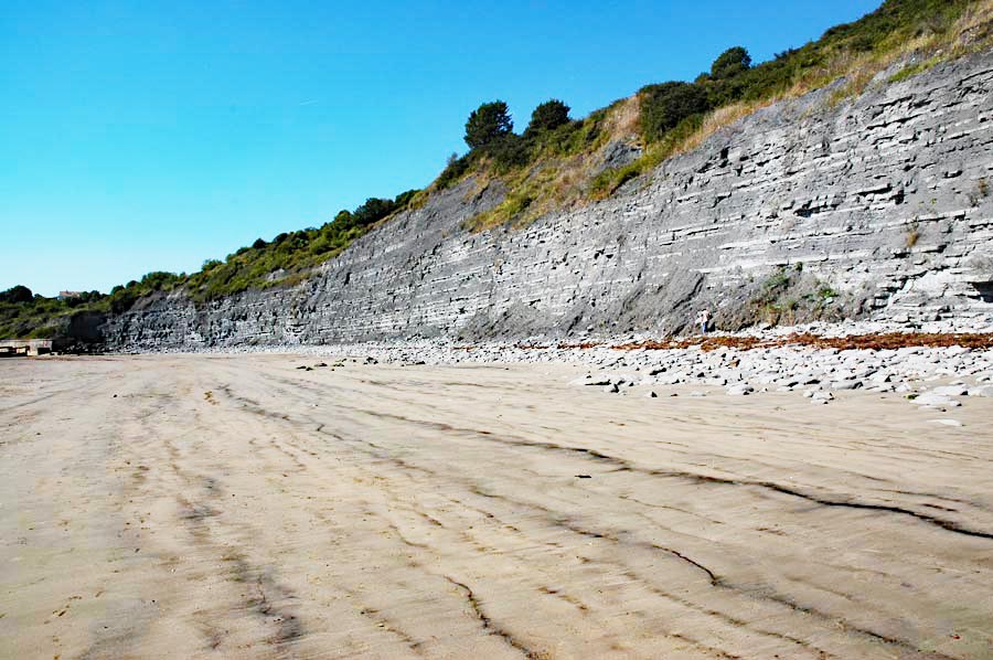
Charmouth cliffs (taken in 2005).
I continued east from Charmouth and ascended to the top of the cliffs. But due to unstable cliffs there is now (2025) an inland diversion to avoid the cliff edges. Here the cliffs are lighter in colour and are Middle Liassic rocks. The path then ascended to Golden Cap, which is the highest point on the south coast. On descending again I passed into Seatown, where The Anchor Inn can be found.
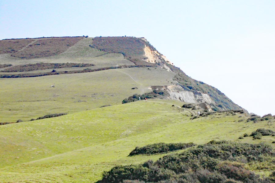 |
 |
| Approaching Golden Cap. | Looking back at Seatown and Golden Cap. |
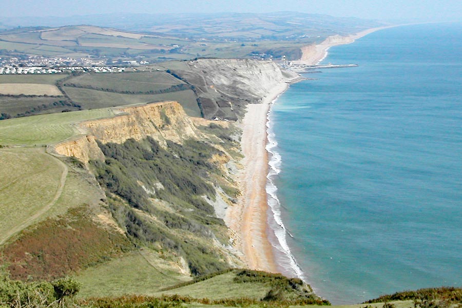
Towards West Bay from Thorncombe Beacon.
After Seatown I ascended to Thorncome Beacon, descended to Eype Mouth, ascended to West Cliff and finally descended to West Bay. I walked into nearby Bridport and caught a bus home.
End of day 1. About 10 miles of the coast path walked today.
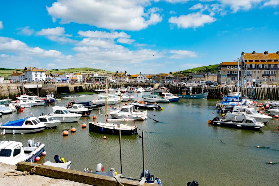
West Bay Harbour (taken in 2018).
Day 2. West Bay to Langton Herring.
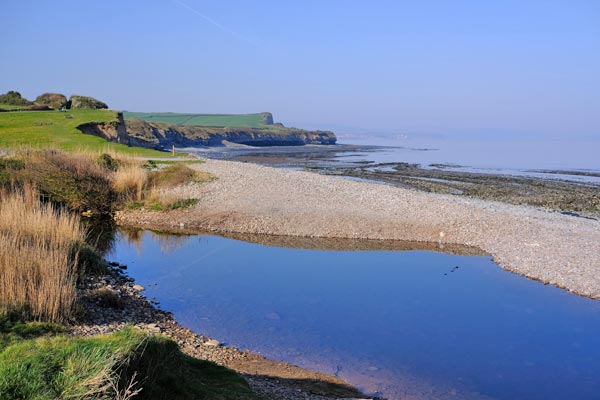
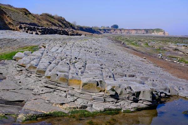
On the east side of the West Bay are the golden yellow Upper Liassic rock cliffs of East Cliff and Burton Bradstock. I made the steep ascent to the top. But now (2025) there is an inland diversion as far as the Freshwater Beach Holiday Park due to their instability and having had many large collapses over the past few years. It is possible to walk along the beach at low tide as far as Freshwater or even Burton Bradstock, keeping well away from the cliffs, but cliff fall rubble has been known to reach the sea during collapses. It is inadvisable to attempt to walk on the rubble of a cliff fall, even if it appears to be solid. People have broken through the crust and become stuck in the mud beneath until extracted by the fire brigade.
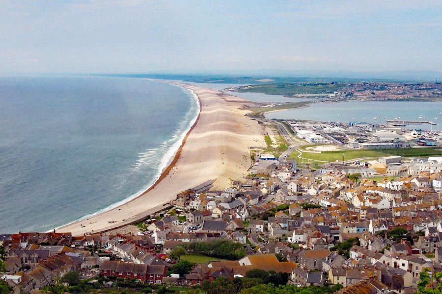
After Burton Bradstock, the cliffs ended and the going got easier. That was the start of the eighteen miles long Chesil Beach, pebbles and shingle all the way to Portland. The path continued along the top of low cliffs and along the seaward edge of a caravan park, then dropped down to a track along the back of the beach. Where the shingle has encroached onto the track the going was tough but I found an opportunity to take a parallel and slightly inland track around Burton Mere and along the edges of the fields for a while. When I walked the other way in 2022 it was marked as the 'summer route' as I believe the fields can get waterlogged in the winter making a walk on the shingle at the back of the beach the only option. It was just under 3 miles to West Bexington and just over 5 miles before the path left the beach and continued inland towards Abbotsbury passing St Chatherine's Chapel on the way. I then continued on the path, now inland, to Langton Herring where I had a pint in the Elm Tree Inn while I waited for my wife to come and drive me home.
End of day 2. About 14 miles walked today.
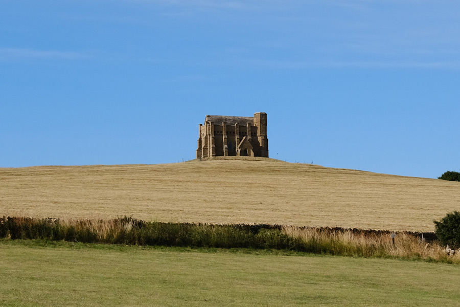 |
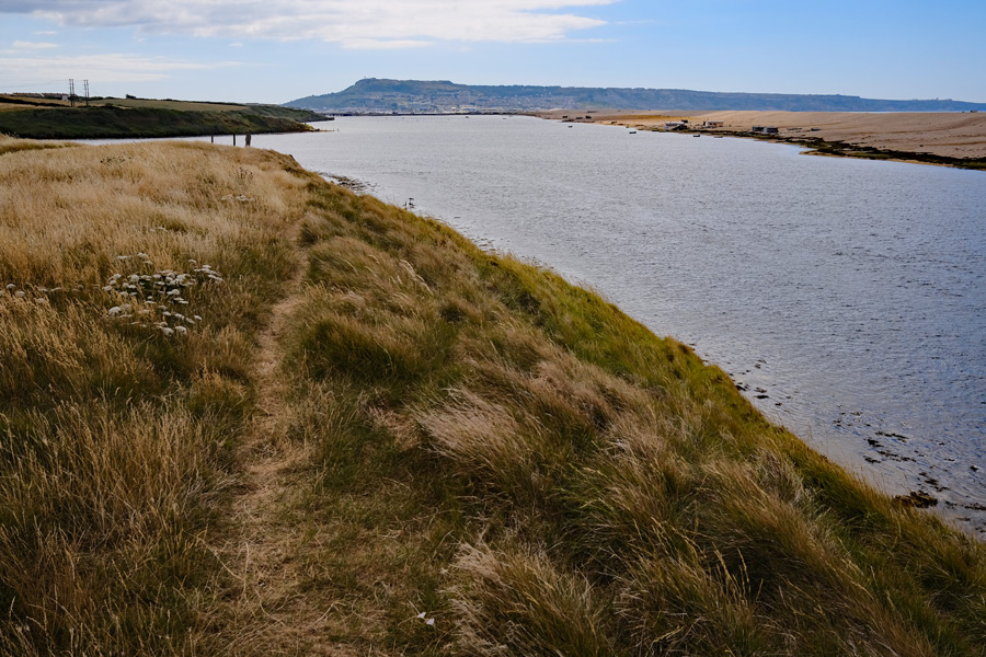 |
| St Catherine's Chapel. | The Fleet. |
End of day 2. About 13 miles walked today.
Day 3. Langton Herring to Osmington Mills.
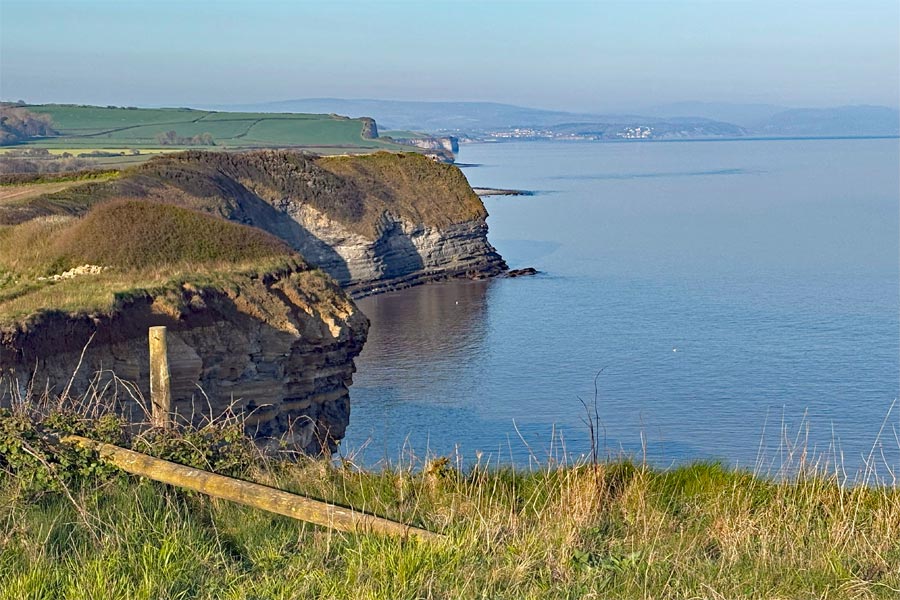
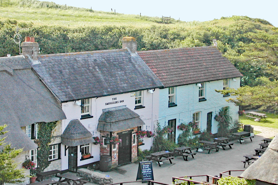
Back at Langton Herring the next day. The path then returned towards the coast but instead of returning to Chesil Beach it arrived at The Fleet, a long expanse of semi-brackish water behind Chesil Beach. The coast path continued along the landward side of The Fleet for about 8 miles before reaching Wyke Regis at the start of the causeway to Portland. From there I walked into Weymouth as Portland was not on my route. I had a pleasant and easy walk into town to Weymouth beach, which was busy with holidaymakers, to the far end of the 2 mile beach where I left the immediate coast at Bowleaze Cove and climbed the path to walk along the low cliffs. It was getting very hot and at Osmington Mills I stopped for a pint at The Smugglers Inn where I was again collected by car.
 |
 |
| Weymouth. | The Smugglers Inn. |
End of day 3. About 15 miles walked today.
Day 4. Osmington Mills to Worth Maltravers.
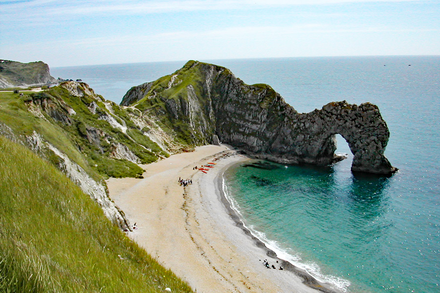
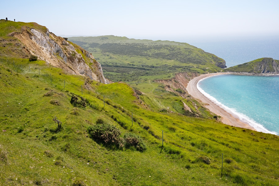
After Osmington Mills the cliffs got higher and there was a strenuous 5 mile walk to get to Durdle Dor and Lulworth Cove. At the top of the cliffs immediately after Lulworth Cove the path passed into the Lulworth Firing Range. From there to Kimmeridge the path was and still is only open on certain weekends and weekdays during the year. For more information Google 'Lulworth Range access times' and choose the .gov.uk site. Take heed of the warning signs - don't pick anything up. The going was again strenuous and at times severe and continued on past Kimmeridge until Chapman's Pool where, exhausted, and late in the day I struggled up the slope of West hill to get to Worth Maltravers, where I had decided to stop. At The Square and Compass, which was very busy, I queued at the little hatch and bought a pint which I drank sat on a large stone as all the seating was taken. Then I wandered back to the coast and found a secluded spot a little way off the path where I slipped into my sleeping bag and fell instantly to sleep. At 21:30 it says in my notes.
 |
 |
| Durdle Dor. | Lulworth (Taken in 2022). |
 |
 |
| Lulworth Range. | Kimmeridge. |
End of day 4. About 18 miles walked today.
Day 5. Worth Maltravers to South Haven Point.
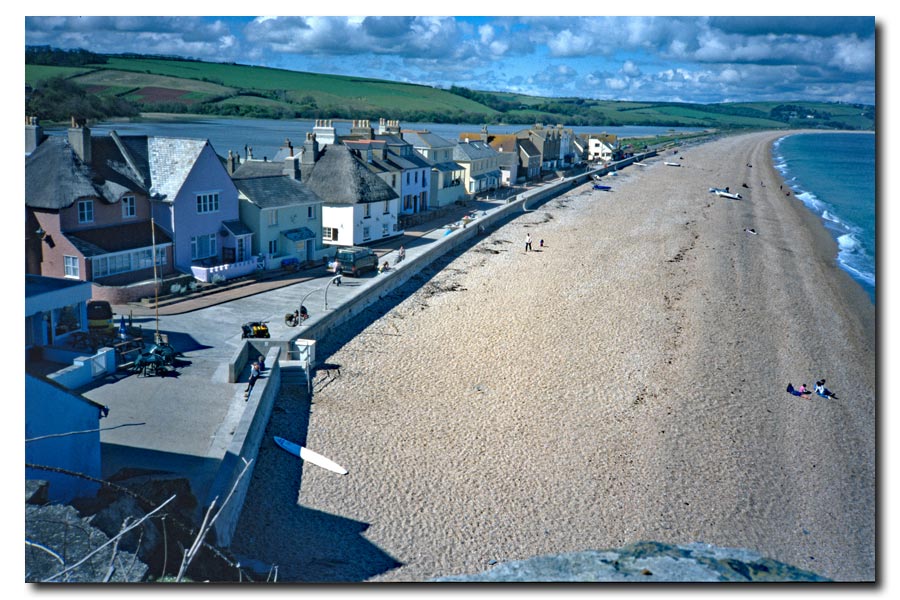
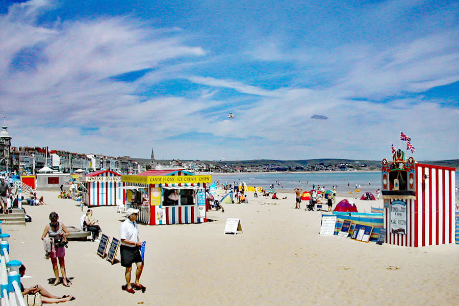
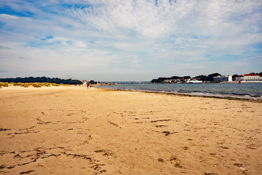
I slept well and was up and on my way again by 05:30. The going was easier than the day before. Thank goodness. I passed Durlston Point and strolled through the Durlston Country Park. After Peveril Point the path descended into Swanage where at 08:45 I had a full English breakfast at the Pier Head Tea Gardens. It was becoming another hot day as I walked along the sea front towards Ballard Down and a long steep climb to the top giving marvelous views of Swanage Bay. And as I walked out along the down the views got even better. My 2005 photograph of Old Harry Rocks shows several chalk stacks in the sea but when I passed by the other way in 2022 the furthest one was no longer there. Continuing on I arrived at Studland village where the path drops down to sea level to the start of a 3 mile stroll along the beach to South Haven Point. Part of Studland beach is a nudist beach. Why is it that most nudists don't have the sort of body that suits a lack of clothes? At the end of the beach is South Haven Point and is the end (or the start) of the SWCP.
 |
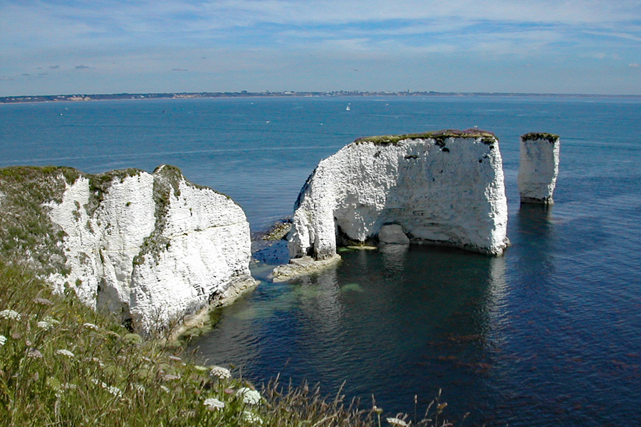 |
| Approaching Swanage. | Old Harry Rocks. |
 |
 |
| Studland. | South Haven Point. The end. |
End of day 5. About 13 miles walked today.
Lyme Regis to South Haven Point: About 69 miles walked. 5 days.
Total: The SWCP from Minehead to South Haven Point: 613 miles in forty two days.
Only 613 miles? Yes. The Isle of Portland was not part of the SWCP when I started out, and it was not in my guide book. So in 2005 I walked from the mainland, along the causeway, around Portland, stopping for lunch at The Pulpit, Portland Bill, and back again. Adding 17 miles and 1 day to the total.
Final SWCP total: 630 miles in forty three days.
Chesil Beach from Portland
Portland Bill

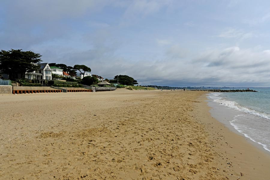
Passing through:Sandbanks, Westborne, Bournemouth, Boscombe, Southbourne, Hengistbury Head, Christchurch, Mudeford and Highcliffe.
This short walk was to allow me to complete the remainder of the Dorset coast that the SWCP does not cover. It ran from the point where the ferry from South Haven Point lands at Sandbanks and ended at Chewton Bunny, Highcliffe, on the border between Dorset and Hampshire.

My chosen camera for this walk was a Fujifilm X-E3, a small and light APS-C mirrorless camera which I mostly used fitted with a Fuji 27mm f2.8 pancake lens. I also took a Fuji 18mm f2 for wide-angle photos. This camera will fit into the small pouch on my rucksack belt, ready for instant use.
Day 1 - Sandbanks to Southbourne.
From my campsite near Corfe it took two buses to get to Sandbanks via Swanage. I alighted the second bus, the number 50, on the Sandbanks side of the ferry. There is no pathway in front of the posh beach houses here. The easy way is to walk on the pavement of the B3369 for just over a mile to where the promenade starts. I chose to use an alleyway between the houses about a quarter of a mile along the road to get to the beach and then walk on the damp sand at the water's edge for a couple of miles before deciding that I was hungry enough to join the promenade to find somewhere for a spot of breakfast.
 |
 |
| The ferry at Sandbanks | Sandbanks beach |
It was late morning and I wanted somewhere to sit with a mug of coffee and a bacon sandwich, but there were only a few concessions selling coffee and take-away fast food and no available seats. Then I spotted Rockwater*, a two-story glass and wood building with a wide set of steps ascending from the promenade. It wasn't what I was looking for but I went in anyway*.
*Rockwater
There was the "Please wait to be seated" sign just inside the door but before I could read the menu, a genial waiter appeared and steered me to a small table for two, gave me a menu and was gone. I took off my rucksack and sat down. The restaurant was packed and it was quite noisy. As I looked around I noticed the other diner's plates with food tastefully arranged in small piles at the centre. I could never understand why they place hot food in a little pile so that it can get cold quickly. Art before logic I suppose. I was hot and was beginning to overheat and was thinking of leaving but the waiter was suddenly there again. I was hungry so I decided to stay and without looking at the prices I spotted "free range scrambled eggs on sourdough toast" which I requested, with a coffee. As I cooled down and relaxed I watched the antics of the smartly dressed little children playing with their food and standing on their seats, being ignored by their smartly dressed young mothers who were deep in animated conversation with each other, stopping only to say "now we don't stand on our chair when we eat do we Nathaniel?" before going back to their conversation. The food was very tasty but I don't usually pay that much for scrambled eggs on toast when I'm on a ramble.
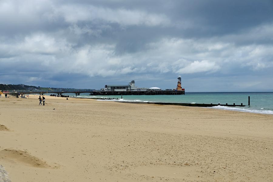 |
 |
| Bournemouth ahead | Hengistbury Head ahead. |
It was warm with a few clouds but there was a brisk wind blowing from the west. By the time I got to Bournemouth, the clouds were thickening and I had to roll my sleeves down and zip my fleece up. I walked on past Boscombe and its Pier and at Southbourne. As the houses fell away behind me and were replaced by open ground and then the Hengistbury Head nature reserve ahead, I turned inland to find the bus stop near the visitor Centre. The bus wasn't due so I wandered towards the visitor centre where I was intercepted by a knowledgeable member of staff who very kindly attempted to explain all that was available at the centre and in the nature reserve beyond. I assume that my rucksack, boots and walking pole had identified me as a likely candidate for the full oration, and I would have listened, but I had a bus to catch. So I waited for a suitable pause, which was just long enough for me to tap my watch*, even though I wasn't wearing one, and say "bus, must go", and head for the bus stop. That was the first of three bus rides needed to get back to the campsite.
*Watch
Since I retired I rarely wear a watch. After spending most of those working years being ruled by two tiny metal pointers moving around a ring of numbers I was glad not to need it much anymore. I can still get that instant lift of spirit when, first thing in the morning, I see it laid out on the sideboard and know that I won't need it that day.
End day 2: About 9.5 miles walked today.
Day 2 - Southbourne to Highcliffe.
It required only two buses to get back to Southbourne but it took three hours. I like traveling, especially on foot but I like bus rides too. But not all bus rides. The journey from Poole was on a very noisy bus which had more than the usual amount of loose fittings that continually rattled as the bus bounced over the slightest bump, and there seemed to be more that the average amount of rough roads to negotiate on that route. The driver also seemed to be in bit of a hurry although the bus was not late, so the ride was rather uncomfortable to say the least, especially when he was negotiating the tight turns along the route. I chose to sit upstairs at the front so as to see the the coastal views from a higher vantage point than I had yesterday, but this was the worst place to sit on this bus, for the lurching over uneven roads and sweeping round the tight turns, especially at speed, was greatly amplified.

Hengistbury Head Nature Reserve
It was sunny and very warm when I arrived back at the visitor centre, which I walked past to get to the entrance the nature reserve and then to the top of Hengistbury Head. From there I could see the two rows of beach huts below, snaking away into the distance with Christchurch harbour on the left and the sandy beach on the right. Descending the hill and walking along the rough track on the harbour side of the beach huts I took the ferry to Mudeford. After a walk along the beach at Mudeford the path ascends the cliff and passes through the grounds of Highcliffe Castle before dropping down again to the beach at Highcliffe. At the end of the beach, at Chewton Bunny, Walkford brook enters the sea. This is the border between Dorset and Hampshire.
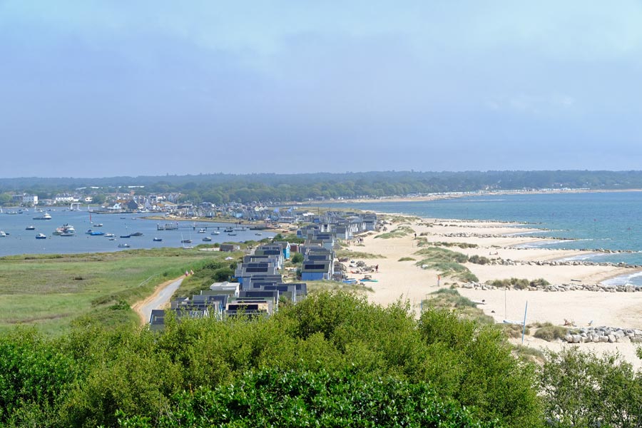
Hengistbury Head view
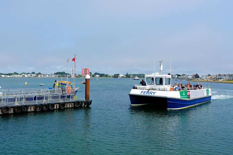 |
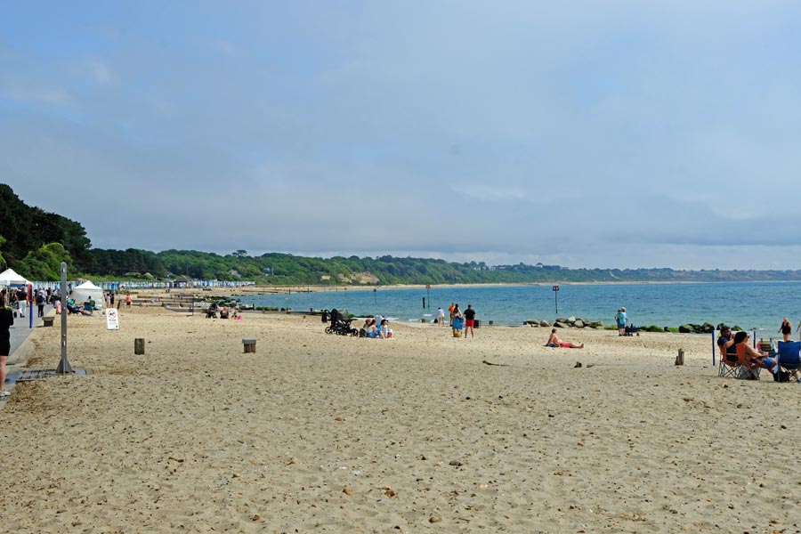 |
| Mudeford Ferry | Mudeford |
 |
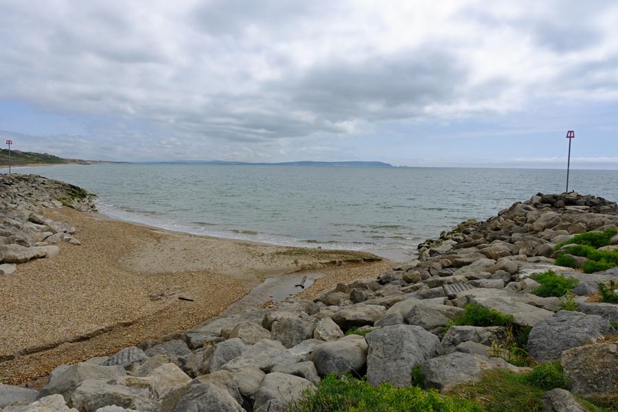 |
| Highcliffe Castle grounds walk | The Hampshire border at Chewton Bunny |
The path then turns uphill and inland to follow Walkford Brook as far as the A227 and shortly afterwards drops back down to continue along the top of the cliffs at Barton on Sea. But from here I walked inland to New Milton station where I caught a train to Wareham (43 minutes) followed by a short bus ride back to Corfe. Much quicker than the bus journeys that morning.
End day 2: About 8.5 miles walked today and about 18 miles in total from Sandbanks.
This could have been a one day walk but I had to spread it over two days due to the traveling time required to get to and from the start and end points.
That's a total of 105 miles in 7.5 days of walking the south west coast in 2025.
Including my earlier South West Coast Path walk makes a total of 735 miles.
This walk continues on the South East Coast page.
All photos © rambleman.uk

Website © 2026 rambleman.uk